The Pacific Institute Drought Response Team provided monthly drought updates during the 2012-2016 California drought. A catalogue of these updates and associated information can be found below.
April 4 – April 26, 2017
Update on the California Drought: April 4 – April 26, 2017
From the Pacific Institute’s California Drought Response Team
Top Story
An Era of Extremes
Looking back over the past five years, meteorological data show that the 60-month period between January 2012 and December 2016 was the hottest on record, with an average temperature of about 60.2 °F. It was also the 11th driest since record keeping began in 1895. While the California drought developed after months of precipitation deficits, the end of the statewide drought came quite swiftly.
Several severe winter storms since the beginning of the 2016/17 water year (which began on October 1, 2016) resulted in floods and nearly caused the Oroville Dam, the nation’s tallest, to fail. Meanwhile, the Northern California mountain region surpassed the wettest water year on record as early as mid-April. NASA data show that the snowpack in the Tuolumne River Basin in California’s Sierra Nevada is larger than the four previous years combined.
On April 7, 2017 Governor Brown issued Executive Order B-40-17, lifting the statewide drought emergency across the state except in Fresno, Kings, Tulare, and Tuolumne counties. These counties face persistent problems with diminished groundwater supplies, which take longer to replenish than surface water. The continuation of emergency drinking water projects in these counties will help their communities cope with local water shortages.
The drastic change from a record-breaking drought to record-breaking precipitation marks a new era of climate extremes. To safeguard Californians against future droughts, the governor’s Executive Order maintained water reporting requirements and prohibitions on wasteful water practices, such as watering during or immediately after rainfall. State agencies have also issued a plan to continue to make water conservation a way of life in California.
In Other News
- The State Water Resources Control Board has approved up to $35 million in Proposition 1 grants and loan forgiveness in order to connect East Porterville residents with dry and contaminated wells to a clean and reliable source of drinking water from the City of Portville. During the drought, hundreds of East Porterville residents had their wells run dry, and those who still have access to groundwater face contamination problems. The project to connect East Porterville to the city of Porterville’s public water system aims to provide a long-term solution to the area’s drought emergency.
- Over 3,200 trees in Bakersfield, located in Kern County, are dead or dying due to drought and insect infestation. This unprecedented number represents about 2.7% to 3.2% of the city’s canopy cover. More than half the trees lost since January 2015 have been coast redwoods, the same species as the tallest tree in the world.
- Following the state’s exceptional March 30 snow survey results, the Bureau of Reclamation, which manages the Central Valley Project (CVP), has announced an increase of water supply allocation for all South-of-Delta contractors to 100% of their contract supply. This is the first full allocation since 2006.
- The Department of Water Resources (DWR) has also increased the allocation of 2017 State Water Project (SWP) water to 100% for contractors north of the Sacramento-San Joaquin Delta and 85% for long-term contractors in other regions. This is the highest allocation since 2006.
- Returns of spawning Klamath River Fall Chinook salmon are projected to be the lowest on record in 2017 due to drought, disease, poor ocean conditions, and other issues. As a result, several fishing areas are expected to be closed in 2017 and the open areas are expected to be significantly constrained.
The Pacific Fishery Management Council (PFMC), which regulates the commercial and recreational fishing of California, Oregon, and Washington fish stocks, will choose among a set of options aimed to limit the total harvest of Klamath River Chinook salmon to no more than 1,600 fish. Only half of this amount would be designated for the Yurok and Hoopa Valley Tribes.
Meanwhile, the Karuk Tribal Council has placed restrictions on subsistence salmon harvests for tribal members for the first time in its history. The reductions in salmon for subsistence and ceremonial use will likely increase economic and cultural burdens on tribes that have long relied on salmon resources.
- A new report by the Pacific Institute found that the five-year California drought led to an increase in electricity costs of approximately $2.45 billion. Due to limited hydropower capacity during the drought, electric generation switched to more carbon-intensive options including natural gas, leading to a 10% increase in CO2 emissions from power plants
- The State Water Board recently rescinded the water supply “stress test” requirements and the remaining mandatory conservation standards for urban water suppliers. However, the monthly water use reporting requirements and prohibitions against wasteful practices are still in effect.
- Urban water conservation remained strong at 25.1% in February 2017 relative to the 2013 water production of the same month. Water use reductions likely resulted from high levels of precipitation and less water demand for outdoor irrigation, which makes up a significant portion of overall residential water use. The cumulative statewide savings from June 2015 through February 2017 was 22.5%, representing about 2.6 million acre-feet of water conserved. This amount is enough to supply more than 13 million Californians for a year.
- A new study by the Alliance for Water Efficiency and Plumbing Manufacturers International (PMI) estimates that replacing non-efficient toilets (1.6 or more gallons per flush) with high efficiency 1.28 gallons-per-flush toilets in residential buildings across Arizona, California, Colorado, Georgia, and Texas could save between 90 and 170 billion gallons of water a year. Toilet flushing is the largest indoor use of water, and toilet replacement is an important strategy to conserve water resources.
California Drought Status
Drought Monitor
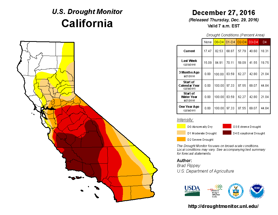
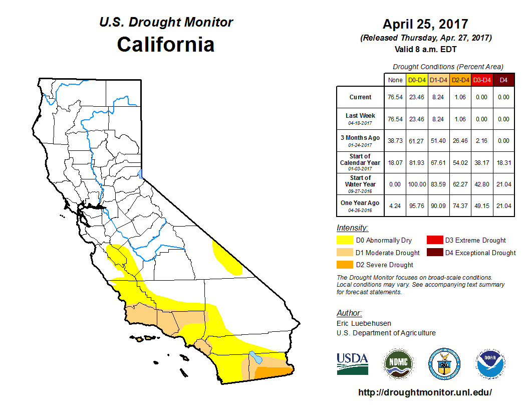 The statewide drought emergency is over, but about 15% of California, concentrated along the Southern Coast, remains abnormally dry as of April 26. Another 8% is experiencing moderate to severe drought conditions, the same as last month. About 77% of the state is identified as drought-free.
Precipitation
Since the beginning of the water year on October 1, 2016, cumulative precipitation in California’s three key hydrologic regions has been far above the long-term average. As of April 26, 2017, the Northern Sierra region has experienced the wettest water year on record, with 92.8 inches of precipitation. Cumulative precipitation in the San Joaquin region is currently at 71.0 inches, putting it on course to match or surpass the wettest year record. Meanwhile the Tulare Basin region remains very wet, with 45.8 inches of accumulated precipitation, almost doubling the long-term average for this date.
California’s snowpack conditions remain excellent; total snowpack from the electronic reading was about 193% of average for April 26.
Reservoir Conditions
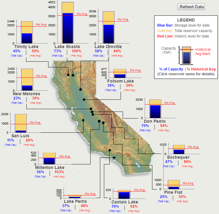
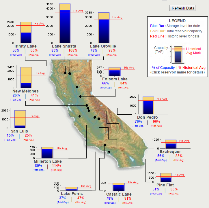
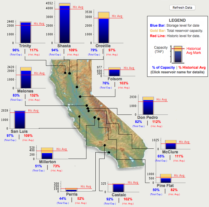 The water levels in California’s major reservoirs (representing 27.3 million acre-feet of storage) remain the same as last month, representing 80% of statewide capacity. Current storage levels are 110% of the historical average for this time of year, slightly higher than last month. As of April 26, conditions at selected reservoirs were as follows:
- The water level at Lake Shasta was at 110% of the historical average for this time of year. Lake Oroville and Folsom Lake were at 99% and 104% of the historical average, respectively.
- The water level at the New Melones Reservoir, another major reservoir with a 2.4 million acre-feet capacity, was at 132% of the historical average for this time of year.
- The water level at the San Luis Reservoir was at 109% of the historical average for this time of year.
- A notable exception is Lake Cachuma, which supplies water to the city of Santa Barbara and other urban areas in Southern California. This reservoir remains well below average, at 58% of the historical average for this time of year as of April 26.
Hydropower
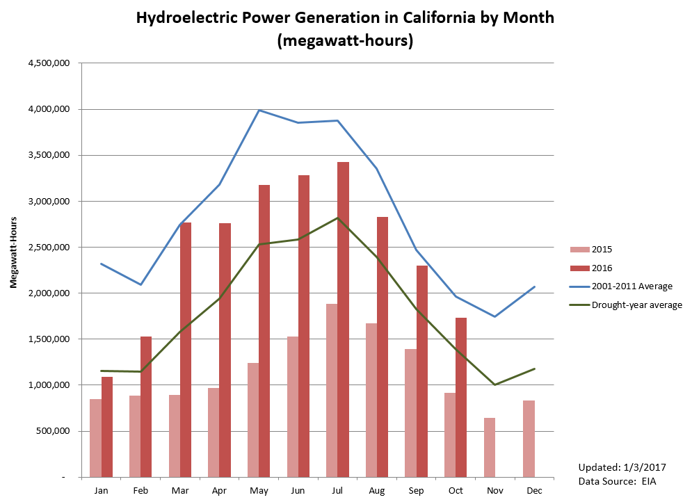
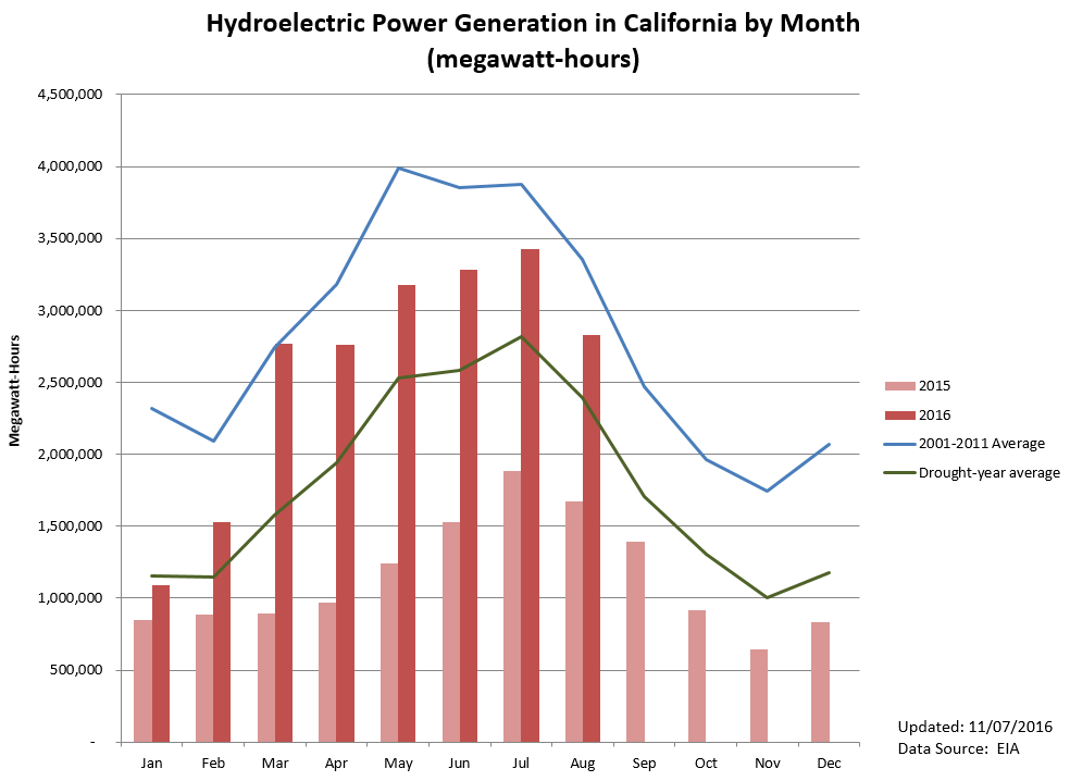
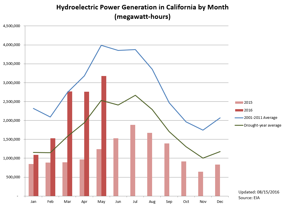
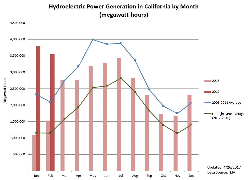 Statewide hydroelectric power generation was about 3,600,000 MWh in February 2017, 132% higher than last year’s February production and 209% higher than the 2012-2016 February average. With record-high precipitation, hydropower production is expected to increase due to snowmelt and will likely peak between May and July 2017.
Groundwater Conditions
Groundwater conditions have likely improved as a result of recent storms, but comprehensive data are updated infrequently. Some recent data are available for adjudicated basins for the 2015-2016 water year.
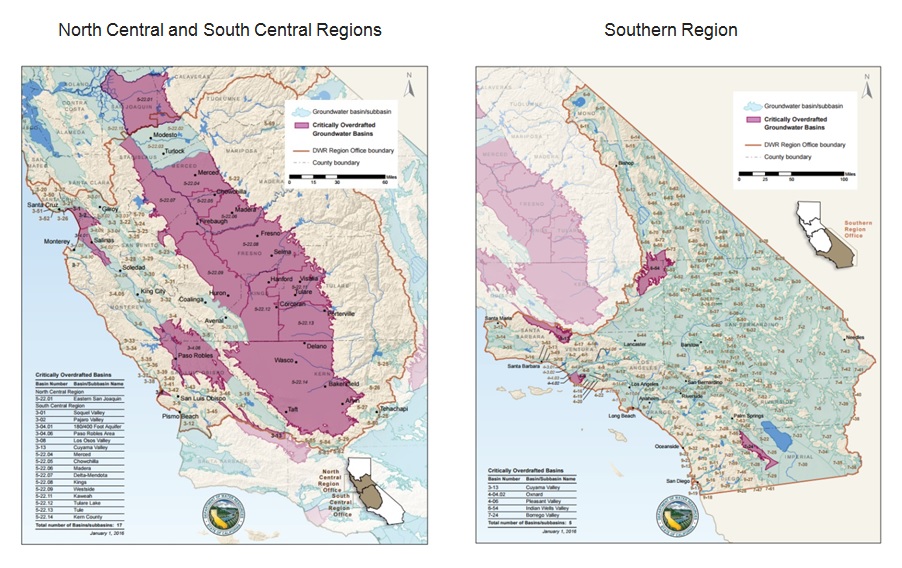
The most comprehensive data on groundwater conditions are based on measurements taken in fall 2016. Maps of spring and fall groundwater level changes can be found here. Parts of the Tulare Lake, the South Coast, and the Colorado River hydrologic regions experienced groundwater declines of more than 100 feet between fall 2011 and fall 2016.
Additional Resources
- The California Data Exchange Center provides California water and weather-related resources including snow surveys and rainfall maps. It is managed by the California Department of Water Resources (DWR).
- A “one-stop shop” for water data and maps is being offered by the National Oceanic and Atmospheric Association (NOAA).
- The Tree Mortality Viewer shows areas of high hazard zones and related information. The tool was created by the Tree Mortality Task Force, comprised of state and federal agencies, local governments, utilities, and other stakeholders.
- The California Harmful Algal Blooms (HABs) Portal provides timely information on reported sightings of the potentially toxic blue-green algal blooms and affected water bodies (Last updated 9/20/2016).
- The Groundwater Information Center (GIC) interactive map is available for public use. Developed by the California Department of Water Resources, it provides visualization for groundwater depth, changes in groundwater level, as well as land subsidence.
- River conditions by the California Nevada River Forecast Center (CNRFC).
- Interactive map of residential and system-wide water use in California by the Pacific Institute.
- California climate anomaly maps and tables by the Western Regional Climate Center (WRCC).
March 7 – April 13, 2017
Update on the California Drought: March 7 – April 3, 2017
From the Pacific Institute’s California Drought Response Team
Top Story
Bills Aim to Provide Long-Term Drought Solutions
Since record-keeping began in 1895, California has experienced the second wettest December through February this winter with 184% of average precipitation. The latest manual snow survey by the Department of Water Resources (DWR) at Phillips station in the Sierra Nevada found a snow-water equivalent (SWE) of 46.1 inches, 183% of the long-term average. (SWE is the depth of water that theoretically would result if the entire snowpack melted instantaneously.) On average, the snowpack supplies about 30% of water needs in California.
As California moves away from a state of drought emergency, it is time to pivot toward long-term solutions to help safeguard the state against future droughts. Several bills have been proposed to this end, including:
- AB 1667: Introduced by Assemblymember Laura Friedman, this bill would require the installation of dedicated landscape water meters on commercial, institutional, industrial, and multifamily service connections. The bill would help water managers measure outdoor water use and better plan for conservation and efficiency measures.
- SB 740: Introduced by Sen. Scott Wiener, this bill would require the State Water Resources Control Board, in consultation with other state agencies, to adopt regulations for developing oversight and management programs for the onsite treatment of water for non-potable use, providing an alternative supply of water.
- SB 252: Introduced by Sen. Bill Dodd, this bill highlights the need for more transparency in new well construction in order to manage groundwater more sustainably. The bill would require a city or county overlying a critically overdrafted basin to make certain information about new wells publicly available and easily accessible before issuing any new well permit. Additionally, the Department of Water Resources would be required to provide utilities overlying a critically overdrafted basin ongoing technical assistance to implement provisions that comply with the bill. If the new plan is approved, a well completion report which includes information on well capacity (such as the estimated pumping rate) would have to be made available to the public.
In Other News
- The US Bureau of Reclamation (USBR) has announced the 2017 water supply allocation for the remaining Central Valley Project (CVP) contractors. All north-of-Delta and in-Delta contractors will receive full allocation. South-of-Delta water contractors serving cities will be allocated 90% of the contract supply while those serving farms and other agricultural areas will be allocated 65% of the contract supply. The low allocation for agricultural water contractors is a result of carryover storage requirements. USBR is likely to increase this initial allocation after more information on snowmelt becomes available. Data on historical water allocations can be found here.
- Despite the rain, Californians have been continuing to conserve water. Statewide water savings for January 2017 was 20.5% compared to the December 2013 production baseline, and 17.2% more than January 2016 savings, when state-mandated conservation targets were in place. Savings from June 2015 through January 2017 totaled over 2.50 million acre-feet.
- NOAA’s Climate Prediction Center has projected that sea surface temperatures in the equatorial Pacific Ocean (i.e., the part of the ocean near the equator) will remain close to the long-term average through at least spring 2017. However, there is an increasing possibility of El Niño developing in the fall. El Niño is associated with dry weather patterns in Hawaii, the Pacific Northwest, the Rocky Mountains, and the Ohio Valley.
- A recent study published in Geophysical Research Letters analyzed the contribution of human water management to the intensification or mitigation of drought in California from 1979 to 2014. Findings showed that in 2014, water management helped to alleviate water shortages by about 50% in Southern California through reservoir reoperation, while human water consumption (primarily through irrigation) increased the duration of drought by 50% and the water deficit in the Central Valley by 50% to 100%.
- A new study from Princeton University found that some droughts can travel hundreds of miles from where they originated and that droughts tend to become larger and more intense before conditions improve. The insight that droughts are a dynamic force similar to hurricanes can help predict their development and forecast their paths.
- A study by Chapman University researchers to evaluate water conservation messaging found that regardless of the strategy, these messages have led to a negative change in attitude. Initial attitudes were generally highly favorable regarding conservation, but this favorability decreased after message exposure. However, the study did not test for the specific reason for the negative effect.
- The Sierra Nevada Conservancy recently published a new report update detailing the dire state of California forests. The combined effects of bark beetles and drought on overgrown forests in the state resulted in about 83 million trees dying between 2014 and 2016. Overgrown forests facilitated the spread of bark beetles. Trees became more vulnerable as the drought reduced their ability to secrete resin to ward away these insects. Additionally, the drought, warmer temperatures, and overgrown forests fueled large, catastrophic wildfires.
California Drought Status
Drought Monitor
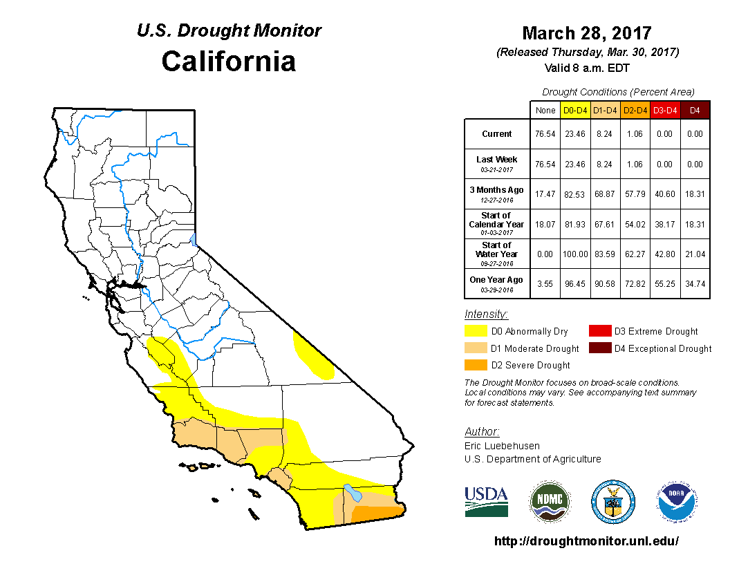 Drought conditions in this period remained relatively the same as last month. The “extreme” and “exceptional” drought designations have been removed from the state’s drought monitor. As of March 28, 2017, about 8% of the state is experiencing moderate to severe drought conditions, a one percentage point decrease from last month. About 77% of the state is identified as drought-free.
Precipitation
Since the beginning of the water year on October 1, 2016, cumulative precipitation in California’s three key hydrologic regions has been far above the long-term average. As of April 3, 2017, the Northern Sierra region had received 83 inches of precipitation and is on track to receive more precipitation than in the 1982-1983 water year, the wettest on record. The San Joaquin and Tulare Basin regions remain very wet, although they are unlikely to surpass the wettest years’ records. As of April 3, these regions had received about 65 and 43 inches of cumulative precipitation, respectively, almost doubling the long-term average for this date.
California’s snowpack conditions are excellent. In early April, the electronic reading showed that total snowpack was about 160% of April 1 average (when snowpack is expected to be at its peak). The manual snow survey conducted on March 30 at Phillips station in the Sierra Nevada found a snow-water equivalent (SWE) of 46.1 inches, 183% of the long-term average for this date.
Reservoir Conditions
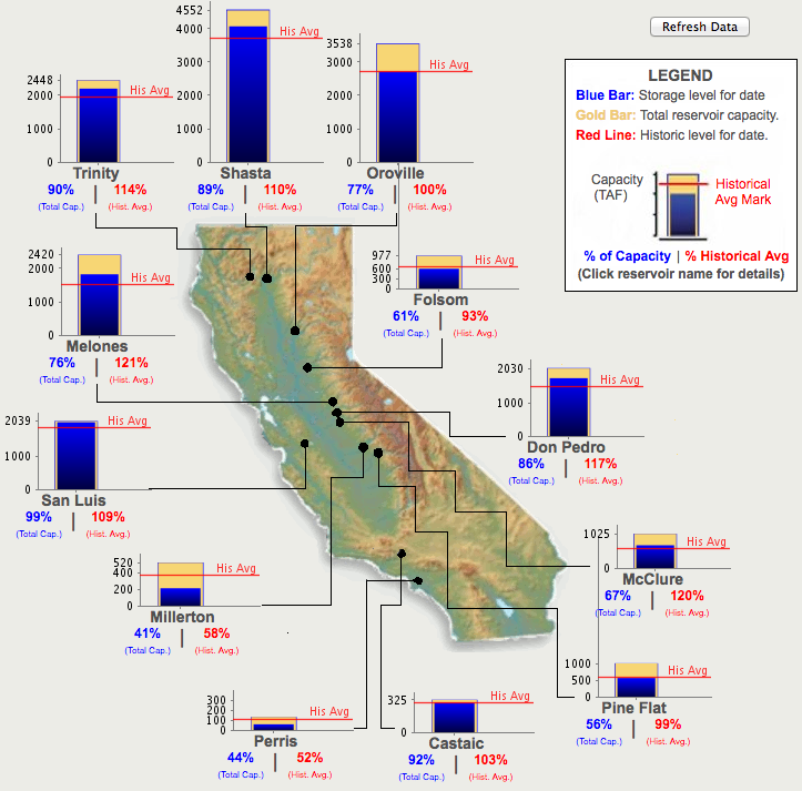 The water levels in California’s major reservoirs (representing 27.3 million acre-feet of storage) have remained the same as last month, representing 76% of the statewide capacity. Current storage levels are 109% of the historical average for this time of year, about 16 percentage points lower than last month. As of April 3, conditions at selected reservoirs were as follows:
- The water level at Lake Shasta was at 110% of the historical average for this time of year. Lake Oroville and Folsom Lake were at 100% and 93% of the historical average, respectively.
- The water level at the New Melones Reservoir, another major reservoir with a 2.4 million acre-feet capacity, was at 121% of the historical average for this time of year.
- The water level at the San Luis Reservoir was at 109% of the historical average for this time of year.
- Lake Cachuma, which supplies water to the city of Santa Barbara and other urban areas in Southern California, remains well below average. Over March, the water level increased slightly from 45% to 48% of capacity. As of April 3, the water level was at 57% of the historical average for this time of year.
Wildfires
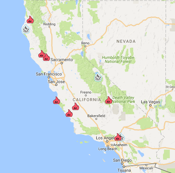
We will resume updates when the 2017 wildfire season begins (typically in May).
Hydropower
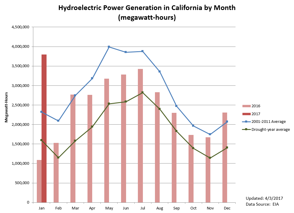 Statewide hydroelectric power generation improved considerably in January 2017. Production was about 3,800,000 MWh, an increase of 250% over last year’s January production of slightly over one million MWh, and an increase of 16% over 2011’s wet January. With record-high precipitation, hydropower production is expected to increase given snowmelt and will likely peak between May and July 2017.
Groundwater Conditions
Groundwater conditions have likely improved as a result of recent storms, but comprehensive data are updated infrequently. Some recent data are available for adjudicated basins for the 2015-2016 water year.
The most comprehensive data on groundwater conditions are based on measurements taken in spring 2016. Maps of spring and fall groundwater level changes can be found here. Parts of the Tulare Lake, the South Coast, and the Colorado River hydrologic regions experienced groundwater declines of more than 100 feet between fall 2011 and fall 2015.
Additional Resources
- The California Data Exchange Center provides California water and weather-related resources including snow surveys and rainfall maps. It is managed by the California Department of Water Resources (DWR).
- A “one-stop shop” for water data and maps is being offered by the National Oceanic and Atmospheric Association (NOAA).
- The Tree Mortality Viewer shows areas of high hazard zones and related information. The tool was created by the Tree Mortality Task Force, comprised of state and federal agencies, local governments, utilities, and other stakeholders.
- The California Harmful Algal Blooms (HABs) Portal provides timely information on reported sightings of the potentially toxic blue-green algal blooms and affected water bodies (Last updated 9/20/2016).
- The Groundwater Information Center (GIC) interactive map is available for public use. Developed by the California Department of Water Resources, it provides visualization for groundwater depth, changes in groundwater level, as well as land subsidence.
- River conditions by the California Nevada River Forecast Center (CNRFC).
- Interactive map of residential and system-wide water use in California by the Pacific Institute.
- California climate anomaly maps and tables by the Western Regional Climate Center (WRCC).
February 1 – March 6, 2017
Update on the California Drought: February 1 – March 6, 2017
From the Pacific Institute’s California Drought Response Team
Top Story
Worst of California Drought Over, But Impacts Linger
Despite a significant improvement in drought conditions, impacts remain. The most recent NASA data reveal that parts of the San Joaquin Valley have been sinking due to groundwater depletion. Between May 2015 and September 2016, significant subsidence was measured in two areas near the towns of Chowchilla, south of Merced, and Corcoran, north of Bakersfield. These “bowls” cover hundreds of square miles, affecting aqueducts and flood control infrastructure. Scientists found that subsidence for some areas in the San Joaquin Valley slowed during the winter of 2015-2016, when rainfall matched crop water needs.
Estimates of adult fall-run Chinook salmon swimming off the coast of California, which serve as a basis for the 2017 fishing allowances, suggest another bleak salmon fishing season for California fishermen. Preseason estimates of the Klamath River fall-run Chinook fell by 62% from 142,200 fish in 2016 to 54,200 in 2017. Sacramento River fall-run Chinook estimates fell from about 300,000 fish in 2016 to 230,000 in 2017. These declines are likely related to the drought’s lingering impacts, as adult salmon returning to California rivers were hatched two to four years ago, when river and ocean conditions were poor.
In Other News
-
- The State Water Board has extended its existing water conservation regulations, prohibiting wasteful water use practices, such as watering lawns after it rains, and setting a conservation mandate for water suppliers projected to face shortages if the drought continues for three more years. A more thorough review of the state’s water supply conditions is being conducted and a reconsideration of the conservation regulations is planned for May 2017.
- New water conservation data reflect continued statewide water saving efforts despite recent rains. Water savings in December 2016 was 20.6% compared to the December 2013 production baseline, 11% higher than December 2015 savings. In all, from June 2015 through December 2016, 2.4 million acre-feet of water were conserved.
- Work on the Oroville Dam continues after the eroded main spillway prompted a two-day evacuation of 188,000 nearby residents. The worst of the crisis seems to be over, unless more severe storms hit Northern California. Last week, the Department of Water Resources halted water releases and shut down the main spillway to remove debris washed into the river channel below and allow the hydroelectric turbines at the base of the dam to resume operation. However, the reduction of the dam’s outflows caused the water level in the Feather River to drop rapidly, resulting in riverbank erosion. Additionally, the reduction of flow has left fall-run Chinook salmon, steelhead trout, and other fish trapped in riverbed pools, prompting rescue operations.
- The US Bureau of Reclamation has announced a full initial allocation for Central Valley Project (CVP) contractors receiving water from the Folsom, New Melones, and Millerton reservoirs, which have unusually high projected runoff from snowmelt. Initial allocation for the remaining water service contractors, predominantly agricultural water districts, will be available in mid-to-late March. The allocation is subject to change based on water conditions.
- On February 2, the second manual snow survey at Phillips Station, near South Lake Tahoe, found a snow water equivalence of 28.1 inches, almost 10 inches higher than the average (or 173% of normal) for this date and about five times higher than the previous month’s measurement. Snow water equivalence is the theoretical depth of water if all snowpack were to melt completely. The California snowpack typically supplies about 30% of the state’s water needs.
- As concern over meeting peak water demand in the summer looms, the City of Santa Barbara is set to restart water production at its mothballed desalination plant in April 2017. The plant, closed since 1992, has a small production capacity of 3,125 acre-feet of water, but could be expanded to produce up to 10,000 acre-feet per year. The capital costs for reactivation are estimated at $70 million with an annual operating and maintenance cost of about $4.1 million at full production, or $1.4 million in non-operation or standby mode.
- The San Jose Water Company, which serves the needs of one million people in San Jose and neighboring communities, has dropped its drought surcharges. The private water company is the last large water supplier in the Bay Area to suspend fines and penalties for excessive water use.
California Drought Status
Drought Monitor
Drought conditions are continuing to improve significantly in California. Precipitation in recent weeks and months has resulted in the removal of the “extreme” and “exceptional” drought designations from the state’s drought monitor. Currently, about 9% of the state is experiencing moderate to severe drought conditions compared to about 50% last month. Over 70% of the state is now identified as being drought-free.
Precipitation
Since the beginning of the water year on October 1, 2016, cumulative precipitation in California’s three key hydrologic regions has been far above the long-term average. As of March 6, 2017, the Northern Sierra and San Joaquin regions had received 78 inches and 62 inches of precipitation, respectively. They are on track to receive more precipitation this water year than in the 1982-1983 water year, the wettest on record. While cumulative precipitation in the Tulare Basin region (currently at 42 inches) is no longer on track to match the region’s wettest recorded water year in 1968-1969, its water level is 205% above average for this date.
California’s snowpack conditions are excellent. As of March 6, total snowpack was about 180% of normal, and 167% of the April 1 average (when snowpack is expected to be at its peak).
Reservoir Conditions
The water levels in California’s major reservoirs (representing 27.3 million acre-feet of storage) have increased by 11 percentage points over the past month, and now represent 76% of the statewide capacity. Current storage levels represent 115% of the historical average for this time of year, about 5 percentage points higher than last month. As of March 6, conditions at selected reservoirs were as follows:
- The water level at Lake Shasta was at 102% of the historical average for this time of year. Lake Oroville and Folsom Lake were at 115% and 68% of the historical average, respectively.
- The water level at the New Melones Reservoir, another major reservoir with a 2.4 million acre-feet capacity, was at 110% of the historical average for this time of year.
- The water level at the San Luis Reservoir was at 115% of the historical average for this time of year.
- Lake Cachuma, which supplies water to the City of Santa Barbara and other urban areas in Southern California, remains well below average. Over January, the water level increased from 12% to 45% of capacity. As of March 6, the water level was at 54% of the historical average for this time of year.
Wildfires
We will resume updates when the 2017 wildfire season begins (typically in May).
Hydropower
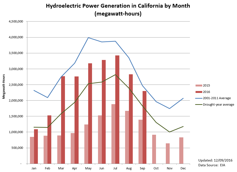
Statewide hydroelectric power generation improved considerably in December 2016. Production was about 2,300,000 MWh, an increase of 176% over last year’s December production of 840,000 MWh and 12% over the 2001-2011 average for the same month. Total hydropower production for 2016 was nearly 29,000,000 MWh, the highest since the drought began in 2012, but still 14% below the average annual production for the period of 2001 to 2011.
Groundwater Conditions
Groundwater conditions have likely improved as a result of recent storms, but comprehensive data are updated infrequently.
The most recent data on groundwater conditions are based on measurements taken in spring 2016. Maps of spring and fall groundwater level changes can be found here. Parts of the Tulare Lake, the South Coast, and the Colorado River hydrologic regions experienced groundwater declines of more than 100 feet between fall 2011 and fall 2015.
Additional Resources
- The California Data Exchange Center provides California water and weather-related resources including snow surveys and rainfall maps. It is managed by the California Department of Water Resources (DWR).
- A “one-stop shop” for water data and maps is being offered by the National Oceanic and Atmospheric Association (NOAA).
- The Tree Mortality Viewer shows areas of high hazard zones and related information. The tool was created by the Tree Mortality Task Force, comprised of state and federal agencies, local governments, utilities, and other stakeholders.
- The California Harmful Algal Blooms (HABs) Portal provides timely information on reported sightings of the potentially toxic blue-green algal blooms and affected water bodies (Last updated 9/20/2016).
- The Groundwater Information Center (GIC) interactive map is available for public use. It was developed by the California Department of Water Resources.
- River conditions by the California Nevada River Forecast Center (CNRFC).
- Interactive map of residential and system-wide water use in California by the Pacific Institute.
- California climate anomaly maps and tables by the Western Regional Climate Center (WRCC).
January 4 - 31, 2017
Special Drought Update — February 13, 2017
Another series of storms has brought heavy rain and strong winds to much of California, causing widespread flooding, especially in Northern California, and threatening the structural integrity of the Oroville Dam, the nation’s tallest. Counties and cities near Lake Oroville have issued emergency evacuation orders for 188,000 residents due to eroded primary and emergency spillways which could lead to the uncontrolled releases of water.
Drought conditions have continued to improve, with about 11% of the state experiencing severe to extreme drought, compared to 20% last week. The area no longer experiencing short-term drought effects has increased from 40% to 41.5% over the past week. La Niña conditions have subsided and normal sea surface temperatures in the Northern Hemisphere are expected to continue through spring 2017. Despite these improvements, drought impacts on overdrafted groundwater basins, forests, and aquatic species in California are long term and will take multiple above-average precipitation years to be resolved.
Update on the California Drought: January 4 – 31, 2017
From the Pacific Institute’s California Drought Response Team
Top Story
A Silver Lining as California Trends Toward More Extreme Weather
The recent wet weather has been topping the news over the last several weeks. In response to severe storms, Governor Jerry Brown has declared a state of emergency in 50 counties across California. The proclamation will help secure funding to help communities respond to and recover from flooding, mudslides, erosion, debris flow, and damage to roads and highways.
Due to winter storms, the U.S. Drought Monitor has removed the designation of “exceptional drought” for California. More than half of the state, however, is still experiencing moderate to extreme drought conditions, with the drought in parts of Ventura, Santa Barbara, Kern, and Los Angeles counties more severe than in the rest of the state. Despite considerable improvements in reservoir and snowpack conditions, groundwater aquifers, forests, and endangered fish species may take several years to recover from drought impacts.
In Other News
- On February 7, the State Water Resources Control Board is scheduled to decide on the extension or modification of statewide conservation rules. State Water Board staff have recommended that the mandate be re-evaluated in May, when the winter rainy season will be over. Meanwhile, the San Diego County Water Authority has announced that the region’s drought has ended and requested that Governor Brown and the State Water Board rescind emergency drought regulations immediately.
- The Department of Water Resources has increased the 2017 State Water Project allocation from 45% to 60% due to recent storms and current water supply conditions. This increase represents a change from 1.9 million acre-feet to 2.5 million acre-feet.
- The Bureau of Reclamation released an outline of Central Valley Project (CVP) water supply conditions. As of mid-January, total CVP water storage was at 107% of the 15-year average. The Bureau plans to announce its initial CVP allocation on or before February 15.
- Stormwater capture systems in Los Angeles County have collected more than 22 billion gallons of stormwater since mid-October, enough to serve the needs of more than half a million residents.
- The city of Roseville and the Placer County Water Agency have agreed to invest a combined $140,000 toward the planning of the Sites Reservoir project, which if successful would become California’s seventh-largest reservoir. The reservoir is projected to cost about $4.4 billion.
- The water level at Lake Mead, an important water source for Arizona, Nevada, and Southern California, may fall enough to trigger water cuts in early 2018. While California will not be immediately affected due to its senior water rights, continued water declines will increase the state’s vulnerability to shortages. For now, federal forecasters remain “cautiously optimistic,” since above-average snowpack in the Rockies could keep the water supply high enough to avoid a shortage declaration.
California Drought Status
A series of winter storms have resulted in record-level precipitation and a removal of the exceptional drought designation from the state’s drought monitor. Currently, about 39% of the state is identified as drought-free. Areas under extreme drought conditions fell from 41% to only 2% over the past month. Nearly half of the state is still experiencing moderate to severe drought conditions.
Precipitation
Since the beginning of the water year on October 1, 2016, cumulative precipitation in California’s three key hydrologic regions is far above the long-term average. As of January 31, 2017, the Northern Sierra and San Joaquin regions have received 53 inches and 43 inches of precipitation, respectively, and are on track to receive more precipitation than in the 1982-1983 water year, the wettest on record. Cumulative precipitation in the Tulare Basin region, currently at 30 inches, is also on track to match the region’s wettest recorded water year in 1968-1969.
California’s snowpack conditions are excellent. Total snowpack is about 180% of normal for January 31, 2017, and 108% of the April 1 average (when snowpack is supposed to be at its peak).
Reservoir Conditions
The water levels in California’s major reservoirs (representing 27.3 million acre-feet of storage) have increased by 19 percentage points over the past month, and now represent 65% of the statewide capacity. Current storage levels represent 110% of the historical average for this time of year, about 17 percentage points higher than last month. Conditions in most reservoirs have improved:
- The water level at Lake Shasta is currently at 117% of the historical average for this time of year. Lake Oroville and Folsom Lake are at 124% and 81% of the historical average, respectively.
- The water level at the New Melones Reservoir, another major reservoir with a 2.4 million acre-feet capacity, is at 70% of the historical average for this time of year.
- The water level at the San Luis Reservoir is now at 105% of the historical average for this time of year.
- Lake Cachuma, which supplies water to the city of Santa Barbara and other urban areas in Southern California, remains well below average. Over January, the water level increased from 8% to 12% of capacity. The current level is 16% of the historical average for this time of year. /li>
We will resume updates when the 2017 wildfire season begins (typically in May).
Hydropower
Statewide hydroelectric power generation improved in November 2016. Production was about 1,700,000 MWh, an increase of 160% over last year’s November production of 650,000 MWh, but it was 4% below the 2001-2011 average for the same month.
Groundwater Conditions
Groundwater conditions have likely improved as a result of recent storms, but data are updated infrequently.
The most recent data on groundwater conditions are based on measurements taken in spring 2016. Maps of spring and fall groundwater level changes can be found here. Parts of the Tulare Lake, the South Coast, and the Colorado River hydrologic regions have experienced groundwater declines of more than 100 feet between fall 2011 and fall 2015.
Additional Resources
- The California Data Exchange Center provides California water and weather-related resources including snow surveys and rainfall maps. It is managed by the California Department of Water Resources (DWR).
- A “one-stop shop” for water data and maps is being offered by the National Oceanic and Atmospheric Association (NOAA).
- The Tree Mortality Viewer shows areas of high hazard zones and related information. The tool was created by the Tree Mortality Task Force, comprised of state and federal agencies, local governments, utilities, and other stakeholders.
- The California Harmful Algal Blooms (HABs) Portal provides timely information on reported sightings of the potentially toxic blue-green algal blooms and affected water bodies.
- The Groundwater Information Center (GIC) interactive map is available for public use. It was developed by the California Department of Water Resources.
- River conditions by the California Nevada River Forecast Center (CNRFC).
- Interactive map of residential and system-wide water use in California by the Pacific Institute.
- California climate anomaly maps and tables by the Western Regional Climate Center (WRCC).
December 13, 2016 - January 3, 2017
Special Drought Update
Pacific storms in early January have brought widespread, intense precipitation to California, providing relief to some drought-stricken regions but also flooding. According to the U.S. Drought Monitor, about 35% of the state is no longer experiencing drought, and the proportion of areas under extreme-to-exceptional drought fell from 38% on January 3rd to 28 percent by January 10. Cumulative precipitation hit a record high, doubling the historical average for this time of year. While a weak La Niña persists, sea surface temperature will transition back to normal by February 2017. Surface reservoirs, especially in Northern California, are beginning to refill, but groundwater aquifers in many parts of the state remain severely overdrafted and will take far longer to recover.
The New Year Begins with Improved Drought Conditions, but California’s Snowpack Still Well Below Average
Happy New Year! Winter storms have improved drought conditions in many parts of the state, especially in the North Coast. Yet, several warm storms in December brought more rain than snow, and the snowpack remains well below average. The first manual snow survey on January 3 at Phillips Station near Lake Tahoe found a snow-water equivalence of six inches, or about 53% of the early-January average of 11.3 inches. The snow-water equivalence is the theoretical depth of water that would result if the snowpack melted instantaneously.
Statewide, the electronic reading shows that the snowpack is about 70% of average for this time of year. Snowpack conditions will likely improve in the coming months, as January and February are among California’s wettest months. Snow measurements between January and April 2017 will guide water management decisions for the rest of the year.
In Other News
- President Obama has signed the Water Infrastructure Improvements for the Nation (WIIN) Act, which contains a contentious drought package for California. While President Obama’s statement on the WIIN Act urged “continued application and implementation of the Endangered Species Act,” some fear that the bill will override endangered species protections.
- Statewide water savings was 18.8% in November, a decrease from 20.2% one year ago. Cumulative savings from June 2015 through November 2016 is 2.35 million acre-feet or 22.6% compared with the same months in 2013. The State Water Board will present a staff proposal to extend emergency conservation regulations for public discussion on January 18. This proposal may re-establish state-mandated conservation targets if the drought worsens or if conservation levels decline drastically.
- The Department of Water Resources (DWR) has boosted the State Water Project (SWP) allocation from 20% to 45%, citing rising reservoir levels from December storms. The DWR will continue to revise SWP allocation based on changing water conditions.
- Nine residents of the town of Hillsborough have filed a lawsuit over their tiered rates and penalties for excessive water use. Because Hillsborough’s water department buys water at a fixed cost from the San Francisco Public Utilities Commission, the lawsuit alleges that the town is charging customers more than the cost of providing water. They argue that this would violate Proposition 218, which was passed by California voters in 1996. The town rejected this argument and countered that their tiered rates reflect the cost of providing water service, which includes sizing the pipes and pump stations to accommodate higher water demand. Further, the town argued that penalties are not subject to Proposition 218.
- A recent study by researchers from the University of California, Davis, and the U.S. Forest Service found that severe wildfires have killed many mature, seed-producing trees, resulting in large forest areas where trees cannot regenerate. Historically, severe wildfires were uncommon, but fire suppression policies and other management practices have led to high fuel loads, which contribute to larger wildfires.
- Researchers from the University of California, Irvine, found that the state’s electricity sector generated 33% more carbon dioxide annually between 2012 and 2014, compared to 2011. The California drought has increased the carbon footprint of energy as the more carbon-intensive natural gas was substituted for the decline in hydropower production.
- The City of Santa Barbara has declared Stage Three Drought Conditions on December 6, requiring a 40% citywide reduction of water use. Irrigation of lawns is prohibited starting January 1, 2017, with some exceptions. Given recent storms, the City may modify its drought status in the coming weeks.
California Drought Status
About 41% of the state remains in extreme-to-exceptional drought, two percentage points less than a month ago. Moderate-to-severe drought conditions affect 28% of the state, four percentage points less than last month. About 17% of the state is now identified as drought-free. The North Coast region has seen the greatest recovery from the drought.
Precipitation
Since the beginning of the water year on October 1, 2016, cumulative precipitation in California’s three key hydrologic regions are now average or above average. The Northern Sierra region is on the course to match the wettest winter in 1982-1983, having accumulated 30.5 inches of precipitation as of January 3, 2017. In the San Joaquin region, cumulative precipitation is about 2 inches above average. After a wet December, cumulative precipitation in the Tulare Basin rose to about 10.9 inches, slightly above the long-term average.
However, most precipitation fell as rain and the state’s snowpack is still about 70% of normal (long-term average) for January 3, 2017.
The NOAA’s next El Niño/ La Niña forecast will be available on January 12, 2017.
Reservoir Conditions
Due to winter reservoir releases, the water level in California’s major reservoirs (representing 27.3 million acre-feet of storage) has decreased by four percentage points to 46% of the statewide capacity compared to a month ago. Current storage levels represent 93% of the historical average for this time of year, about six percentage points higher than last month. Conditions in individual reservoirs have generally improved. For example:
- The water level at Lake Shasta is at 118% of the historical average. Lake Oroville and Folsom Lake are at 91% and 83% of the historical average, respectively.
- The water level at the New Melones Reservoir, another major reservoir with a 2.4 million acre-feet capacity, is at 46% of the historical average.
- The water level at the San Luis Reservoir hit its lowest level in 27 years in mid-August and now stands at 90% of the historical average for this time of year.
- Lake Cachuma, which supplies water to the city of Santa Barbara and other urban areas in Southern California, increased slightly to 8% of its capacity since August 2016. The current level is 11% of the historical average for this time of year.
Areas affected by catastrophic wildfires in 2016 were about 36% less than in 2015. By the year’s end, a total of about 7,200 catastrophic wildfires have burned across 570,000 acres of the state, compared to 890,000 acres in 2015.
Please note that wildfire data are preliminary and may change. They are updated daily by the National Interagency Coordination Center.
Hydropower
Statewide hydroelectric power generation in October 2016 was about 1,700,000 MWh, an increase of 89% over last year’s October production of 920,000 MWh. Total generation was about 12% below the 2001-2011 average for the same month.
Groundwater Conditions
The most recent data on groundwater conditions are based on measurements taken in spring 2016. Maps of spring and fall groundwater level changes can be found here. Parts of the Tulare Lake, the South Coast, and the Colorado River hydrologic regions have experienced groundwater declines of more than 100 feet between fall 2011 and fall 2015.
Additional Resources
- The California Data Exchange Center provides California water and weather related resources including snow surveys and rainfall maps. It is managed by the California Department of Water Resources (DWR).
- A “one-stop shop” for water data and maps is being offered by the National Oceanic and Atmospheric Association (NOAA).
- The Tree Mortality Viewer shows areas of high hazard zones and related information. The tool was created by the Tree Mortality Task Force, comprised of state and federal agencies, local governments, utilities, and other stakeholders.
- The California Harmful Algal Blooms (HABs) Portal provides timely information on reported sightings of the potentially toxic blue-green algal blooms and affected water bodies.
- The Groundwater Information Center (GIC) interactive map is available for public use. It was developed by the California Department of Water Resources.
- River conditions by the California Nevada River Forecast Center (CNRFC).
- Interactive map of residential and system-wide water use in California by the Pacific Institute.
- California climate anomaly maps and tables by the Western Regional Climate Center (WRCC).
November 8 - December 12, 2016
California’s Controversial Drought Provisions Passed by Congress
A controversial California drought package was approved by the House and the Senate after its inclusion in the fast-moving $10 billion Water Infrastructure Improvements for the Nation Act a week earlier. Crafted by Republican House Majority Leader Kevin McCarthy and Democratic Senator Dianne Feinstein, the California-related provisions increase water pumping from the Sacramento-San Joaquin Delta for farming and other purposes in Central and Southern California. The bill also directs $558 million to desalination, water recycling, and water storage projects, among other proposals.
The California drought package was opposed by retiring Senator Barbara Boxer (D-CA) on the grounds that it would undermine the Endangered Species Act protections and adversely affect fisheries and fishing communities. It marks a significant shift in federal policy established under the 1992 Central Valley Project Improvements Act (CVPIA), which focused on the protection of the Delta and endangered species.
The Water Infrastructure Improvement Act passed with a 360-61 vote by the House and a 78-21 vote by the Senate. It is awaiting approval by President Barack Obama.
In Other News
- Californians have continued to save water despite the easing of mandated conservation targets in May 2016. Urban water use in October was 19.5% less than the same month in 2013. While water savings were 2.8 percentage points lower than in October 2015, they represented a slight improvement from the 18.3% savings in September 2016. Cumulative water savings from June 2015 through October 2016 were 22.8%, or about 2.3 million acre-feet.
- California state agencies recently released a draft plan to move the state toward using water more wisely, preparing for future droughts, and preventing water emergencies for vulnerable communities. The draft plan helps to fulfill the first directive of the California Water Action Plan: “Make Conservation a California Way of Life.” Proposed measures include developing new water use targets for urban water utilities that go beyond the existing requirements, permanent prohibitions of wasteful water use practices, monthly water use reporting, and reducing leaks in the water-delivery system.
- The Department of Water Resources (DWR) set the initial State Water Project (SWP) allocation at 20%, citing that “October’s storms and subsequent rainfall have brightened the picture, but [California] could still end up in a sixth year of drought.” Initial allocations frequently change. For example, last year’s allocation was initially set at 10% and was later revised to 60%.
- The U.S. Forest Service has identified an additional 36 million dead trees across California, bringing the total number of dead trees since 2010 to over 102 million on 7.7 million acres of the state’s drought-stricken forests. More trees are expected to die in the coming months and years because of the drought.
- To limit wildfire threats, Cal Fire – the state’s fire management agency – has awarded more than $15 million to various fire safe councils and resource conservation districts across California. These Fire Prevention and Tree Mortality Grants will support fire prevention and suppression programs in rural California.
- The Rancho California Water District in Riverside County has started a program to help district growers replace water-intensive crops, such as avocado, with lower water-use crops, such as wine grapes and citrus trees. The program is funded by a $3 million grant from the U.S. Bureau of Reclamation and the Department of Water Resources, as well as district resources.
- The population of endangered winter-run Chinook salmon has rebounded this year. About twice as many winter-run salmon have been counted on the Sacramento River compared to 2015. Although conditions are still poor, this is a promising development as only 5% and 3% of juvenile winter-run salmon survived in 2014 and 2015, respectively. The long-term average survival rate is about 26.4%.
California Drought Status
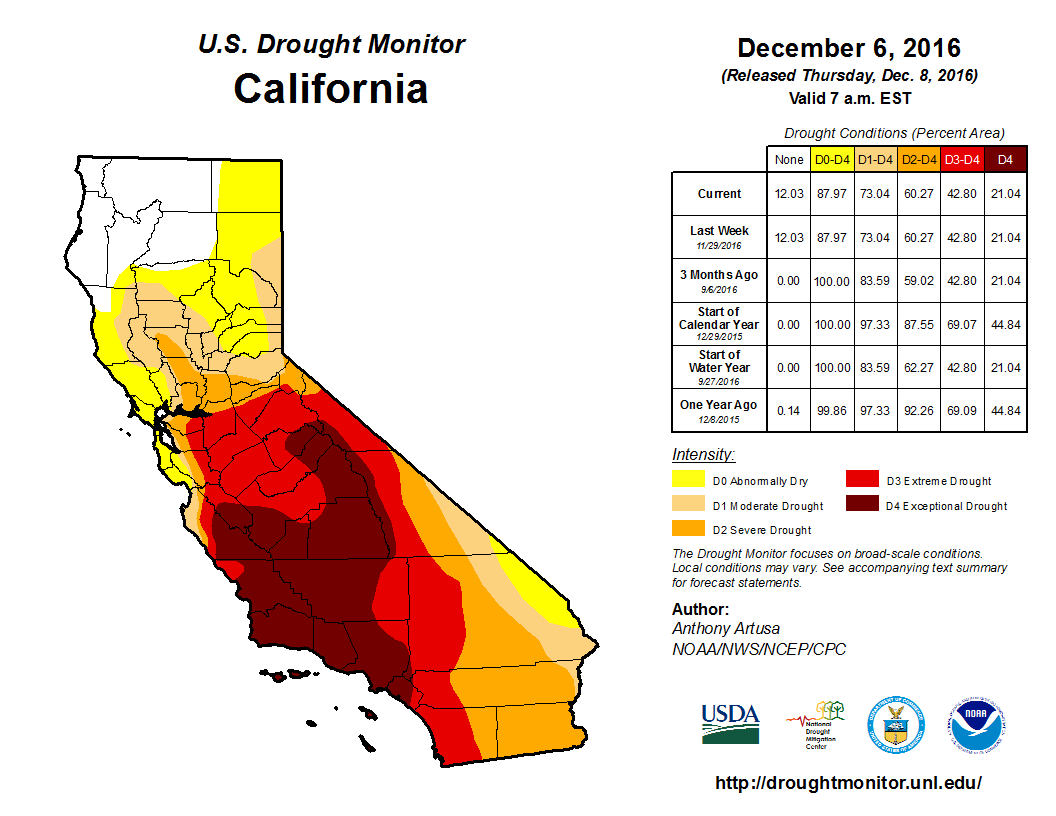
About 43% of the state remains in extreme-to-exceptional drought, the same as three months ago. Moderate-to-severe drought conditions affect 32% of the state, the same as last month. About 12% of the state is now identified as drought-free, namely Del Norte, Humboldt, Siskiyou, and most of Trinity and Shasta counties.
Precipitation
According to the National Oceanic and Atmospheric Administration’s December forecast, La Niña weather conditions are now present, but the weather pattern will likely transition back to normal during January to March 2017. La Niña is expected to contribute to above-average temperatures and below-average precipitation across much of the southern regions of the U.S., including Southern California.
Since the beginning of the water year on October 1, 2016, cumulative precipitation in California’s three key hydrologic regions have varied quite drastically. The Northern Sierra region is experiencing the wettest winter in 30 years, having received about 22.9 inches of rain and snow. In the San Joaquin region, cumulative precipitation is about 2.5 inches above average. However, the Tulare Basin continues to receive very low levels of precipitation, similar to the dry 2014/15 pattern.
Despite a relatively wet start to the winter season, recent storms have not restored the state’s snowpack to normal levels. Statewide snow-water equivalent (or the amount of water contained within the snowpack) is about 57% of the normal level for December 12.
Reservoir Conditions
After the October rains, the water level in California’s major reservoirs (representing 27.3 million acre-feet of storage) has increased by five percentage points to 50% of the statewide capacity compared to a month ago (as of 12/12/16). Current storage levels represent 87% of the historical average for this time of year, also five percentage points higher than last month. Conditions in individual reservoirs vary across the state, with those in the north continuing to do better than those further south. For example:
- The water level at Lake Shasta is at 109% of the historical average. Lake Oroville and Folsom Lake are at 73% and 127% of the historical average, respectively.
- The water level at the New Melones Reservoir, another major reservoir with a 2.4 million acre-feet capacity, is at 40% of the historical average.
- The water level at the San Luis Reservoir hit its lowest level in 27 years in mid-August and now stands at 80% of the historical average for this date.
- Lake Cachuma, which supplies water to the city of Santa Barbara and other urban areas in Southern California, remains very low at 7% of its capacity at least since August 2016. The current level is 10% of the historical average.
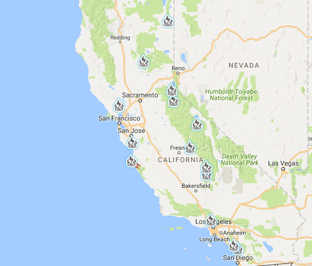
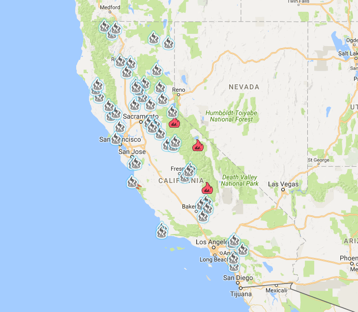
Since the beginning of 2016, a total of approximately 7,200 wildfires have burned almost 570,000 acres across the state (as of 12/12/16). There are now 5 active wildfires in California, according to InciWeb, a national all-risk incident information management system. All wildfires are fully contained.
Please note that wildfire data are preliminary and may change. They are updated daily by the National Interagency Coordination Center.
Hydropower
Statewide hydroelectric power generation in September 2016 was about 2,300,000 MWh, representing a 65% increase over last year’s September production of 1,400,000 MWh. Total generation is about 7% below the 2001-2011 average for the same month.
Groundwater Conditions
The most recent data on groundwater conditions are based on measurements taken in spring 2016. Maps of spring and fall groundwater level changes can be found here. Parts of the Tulare Lake, the South Coast, and the Colorado River hydrologic regions have experienced groundwater declines of more than 100 feet between fall 2011 and fall 2015.
Additional Resources
- The California Data Exchange Center provides California water and weather related resources including snow surveys and rainfall maps. It is managed by the California Department of Water Resources (DWR).
- A “one-stop shop” for water data and maps is being offered by the National Oceanic and Atmospheric Association (NOAA).
- The Tree Mortality Viewer shows areas of high hazard zones and related information. The tool was created by the Tree Mortality Task Force, comprised of state and federal agencies, local governments, utilities, and other stakeholders.
- The California Harmful Algal Blooms (HABs) Portal provides timely information on reported sightings of the potentially toxic blue-green algal blooms and affected water bodies.
- The Groundwater Information Center (GIC) interactive map is available for public use. It was developed by the California Department of Water Resources.
- River conditions by the California Nevada River Forecast Center (CNRFC).
- Interactive map of residential and system-wide water use in California by the Pacific Institute.
- California climate anomaly maps and tables by the Western Regional Climate Center (WRCC).
November 7, 2016
Drought Conditions Improved, But the Shadow of La Niña Looms
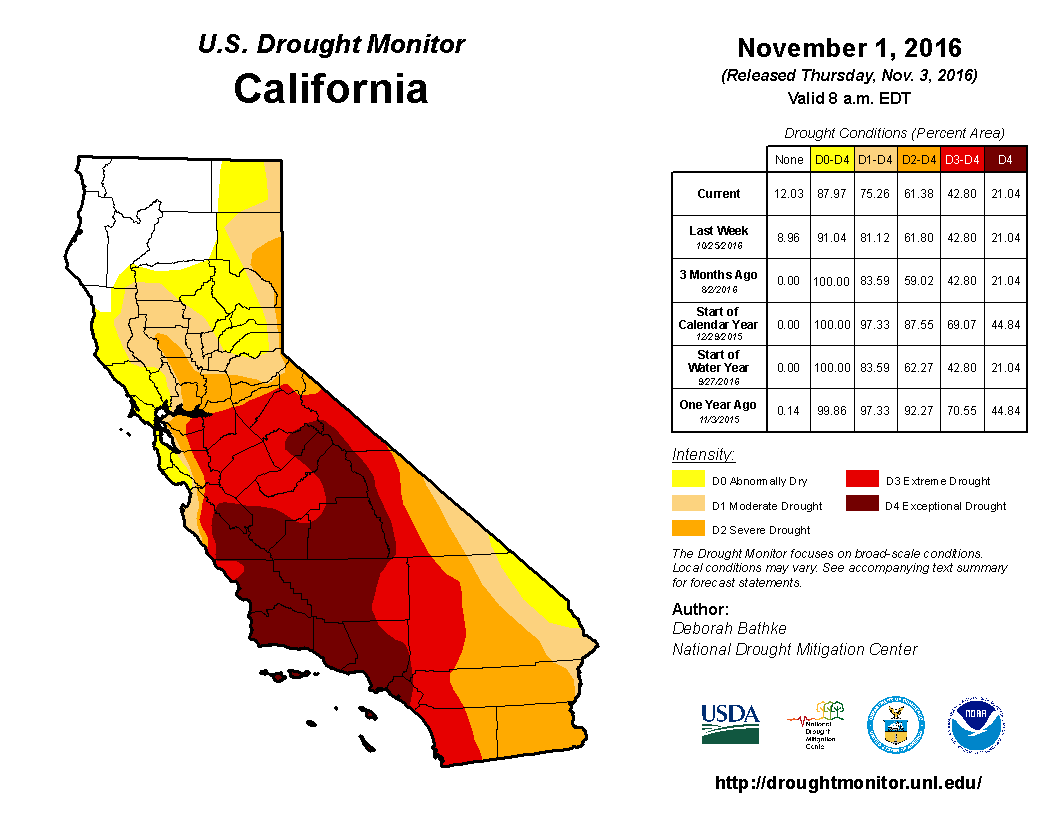
October rains have brought some relief, especially in the northwestern parts of the state, including Humboldt, Del Norte, Siskiyou, and most of Trinity and Shasta counties. According to the U.S. Drought Monitor, 12% of the state is no longer experiencing drought conditions, the highest percentage of drought-free area since March 2013. However, about 43% of the state is still experiencing extreme-to-exceptional drought, unchanged from three months ago.
Satellite images from September and October 2001 and the same months in 2016 reveal the drought’s toll on ten California reservoirs. Scientists have warned that it will still take several years of above-normal precipitation for soil moisture levels, reservoirs, and groundwater aquifers to recover.
At the same time, a new forecast by the National Oceanic and Atmospheric Administration’s (NOAA) Climate Prediction Center suggests that the likelihood of La Niña, a climate pattern linked to drier weather in California, has increased. There is now a 70% chance that La Niña will develop in the fall of 2016 and a 55% chance that it may persist during the winter of 2016/2017.
In Other News
- Urban water use for September 2016 was 18.3% less than water use for September 2013. This value represents an eight-percentage point drop from the September 2015 water savings of 26.2%. Houeshold water use was highest in the Colorado River region, at 188 gallons per person per day. The San Francisco Bay and the North Coast regions had the lowest household water use, averaging about 80 gallons per person per day.
- A study by researchers at Cornell University found that the risk of megadrought in the Southwestern United States may increase to 99% by the end of this century if temperatures continues to rise.
- The Department of Water Resources (DWR), Cal Fire, and the National Weather Service (NWS) warned of the potential for flash flooding during the rainy winter months. Areas affected by wildfires are at a higher risk of erosion and flash floods during a period of intense rainfall because vegetation has been burned away and bare grounds tend to repel water.
- A recent report by the Bay Institute entitled “San Francisco Bay: The Freshwater-Starved Estuary” shows that large-scale water diversions in the Bay’s watershed have exacerbated drought impacts on ecosystems and caused the Bay to be critically dry in 19 of the last 30 years.
- Researchers at the University of California, Los Angeles, and Oregon State University have concluded that greenhouse gases played a role in the record-low 2015 snowpack in California. Through regional climate model simulations, the study showed that both human influence and sea surface temperature anomalies contributed to the risk of snow drought, or periods of a lack of snow, in California. This correlation is even stronger in Oregon and Washington.
- A mass of unusually warm water, also known as “the Blob,” has moved into the northeastern region of the Pacific Ocean. Since 2014, it has worsened drought impacts on anadromous fish (e.g., salmon) and other marine species by disrupting the ocean food chain and creating conditions that have led to toxic algal blooms along the coast of Western United States.
- Scientists have detected high levels of a freshwater algae toxin known as microcystin in shellfish in the San Francisco Bay. Microcystins are produced by the blue-green algae that is blooming in many of California’s waterways, partially because of the drought.
California Drought Status
While 43% of the state remains in extreme-to-exceptional drought, important changes have occurred in the northwestern parts of California as of November 1, 2016. Areas affected by moderate-to-severe drought conditions have declined from 41% to 32% of the state over the past month. About 12% of the state is now identified as drought-free, namely Del Norte, Humboldt, Siskiyou, and most of Trinity and Shasta counties.
Precipitation
The NOAA’s October forecast indicates that La Niña has a 70% chance of developing this fall, and a 55% chance of persisting during the winter of 2016/2017. This new prediction brings back concerns about continued drought conditions.
The new water year began on October 1, 2016. A 3-month precipitation outlook (Dec-Jan-Feb) shows a normal precipitation pattern for Northern California, but a slightly below average precipitation for Southern California.
Reservoir Conditions
After the October rains, water levels in California’s major reservoirs (representing 27.3 million acre-feet of storage) have increased by one percentage point to 44% of the statewide capacity compared to a month ago. Current storage levels represent 81% of the historical average for this time of year, five percentage points higher than the previous month. Conditions in individual reservoirs vary across the state, with those in the north continuing to do better than those further south. For example:
- The water level at Lake Shasta is at 105% of the historical average. Lake Oroville and Folsom Lake are at 73% and 76% of the historical average, respectively.
- The water level at the New Melones Reservoir, another major reservoir with a 2.4 million acre-feet capacity, is at 38% of the historical average.
- The water level at the San Luis Reservoir hit its lowest level in 27 years in mid-August and now stands at 59% of the historical average for this date.
- Lake Cachuma, which supplies water to the city of Santa Barbara and other urban areas in Southern California, remains very low at 7% of its capacity, or 10% of the historical average.
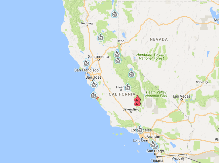
Since the beginning of 2016, a total of 7,206 wildfires have burned over 560,000 acres across the state. There are currently 10 active wildfires in California, according to InciWeb, a national all-risk incident information management system. All the largest active wildfires (over 8,000 acres) are fully contained.
Please note that wildfire data are preliminary and may change. They are updated daily by the National Interagency Coordination Center
Hydropower
Hydroelectric power generation in August 2016 was about 2,800,000 MWh, representing a 70% increase over last year’s August production of 1,700,000 MWh. However, hydropower generation is still 16% below the 2001-2011 average for the same month.
Groundwater Conditions
The most recent data on groundwater conditions are based on measurements taken in spring 2016. Maps of spring and fall groundwater level changes can be found here. Parts of the Tulare Lake, the South Coast, and the Colorado River hydrologic regions have experienced groundwater declines of more than 100 feet between fall 2011 and fall 2015.
Additional Resources
- The California Data Exchange Center provides California water and weather related resources including snow surveys and rainfall maps. It is managed by the California Department of Water Resources (DWR).
- A “one-stop shop” for water data and maps is being offered by the National Oceanic and Atmospheric Association (NOAA).
- The Tree Mortality Viewer shows areas of high hazard zones and relation information. The tool was created by the Tree Mortality Task Force, comprised of state and federal agencies, local governments, utilities, and other stakeholders.
- The California Harmful Algal Blooms (HABs) Portal provides timely information on reported sightings of the potentially toxic blue-green algal blooms and affected water bodies.
- The Groundwater Information Center (GIC) interactive map is available for public use. It was developed by the California Department of Water Resources.
- River conditions by the California Nevada River Forecast Center (CNRFC).
- Interactive map of residential and system-wide water use in California by the Pacific Institute.
- California climate anomaly maps and tables by the Western Regional Climate Center (WRCC).
September 27, 2016
California May Be Entering Its Sixth Year of Drought, but Is the Glass Half Full or Half Empty?
The 2016 water year has come and gone. Starting on October 1, 2015 and ending on September 30, 2016, the past water year brought some respite to parched areas in Northern California, which received average to slightly above average precipitation, although precipitation in Southern California remained well below average. In Northern California, spring runoff was significantly below average due to several factors, including the replenishment of depleted soil moisture, increased uptake by vegetation, and less precipitation falling as snow. The Department of Water Resources (DWR) is beginning to describe this low snowpack condition as a “snow drought,” and it is likely to occur more frequently as a result of climate change.
In a new report summarizing drought conditions for the 2016 water year, DWR shows that the 2012-2015 period encompasses the driest four consecutive water years in California since 1895, with statewide precipitation at only 62.2 inches. The second driest four consecutive years was 1917-1920, with 63.1 inches of precipitation, when California had a much smaller population and far fewer acres of farmland.
The forecast for the 2017 water year is still uncertain. The weakened La Niña conditions offer the possibility of a wetter year ahead, but forecasters remain wary. It will take a long time before the end of drought finally arrives as the state needs multiple, consecutive wet winters, and ideally cooler years, to increase soil moisture and allow the mountain snowpack to accumulate.
Despite some grim facts about the drought, California is taking important steps to glean opportunities from this crisis. At the end of September, Governor Jerry Brown signed several water bills that will help prepare the state for future droughts and address ongoing water scarcity concerns. Here is a selection of noteworthy legislation:
- AB 1755 (The Open and Transparent Water Data Act) requires the DWR and relevant agencies to develop protocols for data sharing, documentation, quality control, public access, and other tools – all of which will aid in water transfer decision-making process.
- SB 552 enables the state to contract with third-party administrators with expertise in improving failing public water systems and helping to provide disadvantaged communities with safe, affordable drinking water.
- SB 1263 prevents the construction of new public water systems that will be unable to provide affordable, safe drinking water in the reasonably foreseeable future.
- SB 814 prohibits excessive water use by a residential customer during a declared drought period. It authorizes methods to discourage excessive use, including water budgets and drought surcharges and penalties.
- AB 2594 expands on the existing law and authorizes a public entity that captures stormwater to use the captured water under certain circumstances.
In Other News
- The State Water Resources Control Board announced that urban water conservation for August 2016 fell to 18%, a decrease from 27% savings in August 2015. Conservation has dropped steeply among some local water suppliers but remains strong among others. If drought conditions worsen along with conservation efforts, the state may bring back mandatory conservation measures in January 2017.
- A new study, using aerial imagery and geospatial techniques, found that land conversion to almond orchards between 2007 and 2014 increased annual statewide water use for irrigation by 27%. While some orchards were simply converted to almonds from other crops (such as corn, cotton, winter wheat, and tomatoes), others were planted on formerly natural landscapes, including wetlands. Addendum: The Almond Board has released a statement disputing these findings.
- Extensive toxic algal blooms continue to invade California waterways. More incidents have been found in Grantline Canal and the Old River surrounding the Fabian Tract in San Joaquin County. Concentrations of the toxin are patchy; the highest levels observed are at the western edge of the Fabian Tract. Other cases of algal bloom have led to the closure of two more lakes in the San Francisco Bay Area: Lake Temescal in Oakland and Quarry Lakes in Fremont. Contact with and/or consumption of the blue-green algae may cause allergic skin rashes, mouth ulcers, vomiting, diarrhea, and cold and flu-like symptoms.
- Water contractors in the San Joaquin Valley are suing the Bureau of Reclamation for $350 million for not delivering water to them in 2014. Despite the fact that the Bureau’s decision was in response to the drought, the lawsuit, filed by 17 water districts, claims that there were sufficient supplies in Millerton Lake that year and that the decision caused farmers and the water districts to lose millions of dollars.
- Five Santa Barbara County water agencies – Carpinteria, Guadalupe, Santa Maria, Solvang, and the Santa Ynez River Water Conservation District Improvement District No.1 – are seeking to reacquire their suspended amount of State Water Project deliveries, approximately 12,000 acre-feet per year, to serve as a drought buffer. This move is part of a response to extremely low water levels in Lake Cachuma, one of their main water sources.
California Drought Status
 Drought Monitor
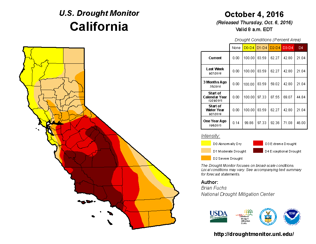
There continues to be no change in drought conditions over the past two weeks. Severe-to-exceptional drought extends across 43% of the state, while moderate-to-severe drought extends across an additional 41% of the state.
Precipitation
The NOAA’s September forecast indicates that La Niña may not emerge this winter, as its chance of occurring has fallen below the 50% threshold.
The new water year began on October 1. A 1.5-month precipitation outlook (Nov-Dec-Jan) shows a normal precipitation pattern, but it is too early to know how conditions will evolve.
Reservoir Conditions
Water levels in California’s major reservoirs (representing 27.3 million acre-feet of storage) have fallen by three percentage points to 43% of the statewide capacity over the past two weeks. Compared to historical data, current storage levels represent 77% of the reported average for this time of year, three percentage points lower than two weeks ago. Conditions in individual reservoirs vary across the state, with those in the north of the state doing better than those further south. For example:
- The water level at Lake Shasta is at 102% of the historical average. Lake Oroville and Folsom Lake are at 73% and 55% of the historical average, respectively.
- The water level at the New Melones Reservoir, another major reservoir with a 2.4 million acre-feet capacity, remains at 39% of the historical average.
- The water level at the San Luis Reservoir hit its lowest level in 27 years in mid-August and now stands at 52% of the historical average for this date.
- Lake Cachuma, which supplies water to the city of Santa Barbara and other urban areas in Southern California, is still at 7% of its capacity, or 9% of the historical average.
 Wildfires
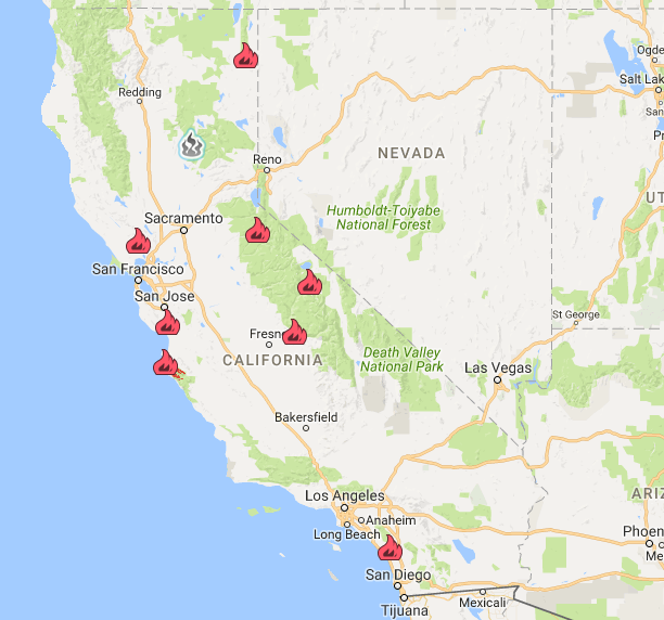
Since the beginning of 2016, a total of 6,645 wildfires have burned over 600,000 acres across the state. The fires have spread by 87,000 acres, or 17%, over the last two weeks. The Soberanes Fire in Los Padres National Forest is still the largest active wildfire in the state, covering more than 130,000 acres and larger than the Gap Fire, Cedar Fire, and Rey Fire combined.
 Hydropower
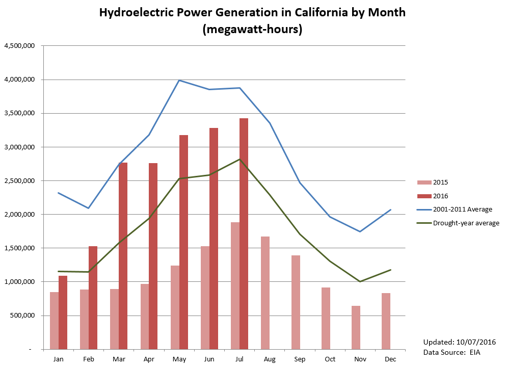
Hydroelectric power generation in July 2016 was about 3,400,000 MWh, representing an 82% increase over last year’s July production of 1,900,000 MWh. However, hydropower generation is still 12% below the 2001-2011 average for the same month.
Groundwater Conditions
The most recent data on groundwater conditions are based on measurements taken in spring 2016. Maps of spring and fall groundwater level changes can be found here. Parts of the Tulare Lake, the South Coast, and the Colorado River hydrologic regions have experienced groundwater declines in excess of 100 feet between Fall 2011 and Fall 2015.
Addendum: A new study, using aerial imagery and geospatial techniques, found that land conversion to almond orchards between 2007 and 2014 increased annual statewide water use for irrigation by 27%. While some orchards were simply converted to almonds from other crops (such as corn, cotton, winter wheat, and tomatoes), others were planted on formerly natural landscapes, including wetlands. The Almond Board has released a statement disputing these findings.
Additional Resources
- The California Data Exchange Center, provides California water and weather related resources including snow surveys and rainfall maps. It is managed by the California Department of Water Resources (DWR).
- A “One-stop shop” for water data and maps is being offered by the National Oceanic and Atmospheric Association (NOAA).
- The Tree Mortality Viewer shows areas of high hazard zones and relation information. The tool was created by the Tree Mortality Task Force, comprised of state and federal agencies, local governments, utilities, and other stakeholders.
- The California Harmful Algal Blooms (HABs) Portal provides timely information on reported sightings of the potentially toxic blue-green algal blooms and affected water bodies.
- The Groundwater Information Center (GIC) interactive map is available for public use. It was developed by the California Department of Water Resources.
- River conditions by the California Nevada River Forecast Center (CNRFC).
- Interactive map of residential and system-wide water use in California by the Pacific Institute.
- California climate anomaly maps and tables by the Western Regional Climate Center (WRCC).
September 13, 2016
Water Management: A Balancing Act
The State Water Resources Control Board released a draft proposal to update water quality requirements for salinity levels in the southern Delta and water flows in the San Joaquin River and its tributaries, namely the Stanislaus, Tuolumne, and Merced rivers. The proposal aims to increase flows for fish and wildlife and lower salt levels to protect farms in the southern Delta and recommends leaving 30% to 50% of unimpaired flow in the Lower San Joaquin River and its tributaries, with a starting point of 40%.
These changes are part of a balancing act to protect at-risk native fish species and their sensitive habitats and to provide sufficient water for human uses. Addressing these issues will also provide a platform for responding to future droughts and adapting to climate change.
In Other News
- Across California, toxic algal blooms have affected more than 40 lakes and waterways in 2016, the highest count ever recorded and nearly double the number reported in 2015. These algal blooms are driven by drought-related factors, such as warmer temperatures, reduced flows, and high nutrient concentrations. More information can be found on the state’s Harmful Algal Bloom (HAB) portal, which provides information on voluntarily reported sightings of these blooms and the affected water bodies.
- The Open and Transparent Water Data Act (AB 1755) has been signed into law. Authored by Assemblymember Bill Dodd, D-Solano, the law requires the California Department of Water Resources to create, operate, and maintain a statewide integrated water data platform that would integrate existing water and ecological data from multiple databases to support data sharing and water transfer activities across the state.
- Governor Jerry Brown signed the Water Efficiency: Landscape Irrigation Equipment Act (AB 1928), which postpones the deadline for the California Energy Commission to establish water efficiency standards for landscape irrigation equipment and labeling requirements to January 1, 2019. Previous laws required an adoption of performance standards and labeling requirements on or after January 1, 2010, and prohibited the sale of equipment not meeting those standards on or after January 2012. However, limited funding and other factors have led to the delay in meeting these deadlines.
- A recent study led by a UCLA researcher suggests that the Pacific Ocean’s response to greenhouse gases could extend drought-like conditions for centuries. Through radiative forcing, natural climatic forces have caused centuries-long and even millennia-long periods of dryness in California during the past 10,000 years, and these conditions were closely tied to prolonged changes in Pacific Ocean surface temperatures. The findings suggest that rising atmospheric greenhouse gas levels would further contribute to prolonged drought-like conditions in the future.
- A region of anomalously warm ocean temperatures is forming in the far northeastern part of the Pacific Ocean. This anomaly resembles the North Pacific “Blob,” which has recurred during the past dry winters and coincided with the “Ridiculously Resilient Ridge,” a persistent region of high atmospheric pressure. It is still unclear how the combination of these phenomena will influence precipitation levels and the timing of precipitation in California.
California Drought Status
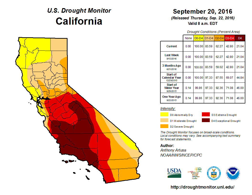 Drought Monitor
There continues to be no change to drought conditions over the past two weeks. Severe-to-exceptional drought extends across 43% of the state, while moderate-to-severe drought extends across an additional 41% of the state.
Precipitation
The NOAA’s September forecast indicates that La Niña may not emerge this winter, as its chance of occurring has fallen below the 50% threshold.
Cumulative precipitation since the beginning of the water year (Oct. 1) has remained the same at near average (40 inches) in the San Joaquin River Basin, above average (57.8 inches) in the Northern Sierra region, and below average (25.8 inches) in the Tulare Lake Basin.
Reservoir Conditions
Water levels in California’s major reservoirs (representing 27.3 million acre-feet of storage) have remained at 46% of the statewide capacity over the past two weeks. Compared to historical data, however, current storage levels represent 80% of the reported average for this time of year, two percentage points higher than two weeks ago. Conditions in individual reservoirs vary across the state, with those in the north of the state doing better than those further south. For example:
- The water level at Lake Shasta is at 104% of the historical average. Lake Oroville and Folsom Lake are at 75% and 56% of the historical average, respectively.
- The water level at the New Melones Reservoir, another major reservoir with a 2.4 million acre-feet capacity, remains at 39% of the historical average.
- The water level at the San Luis Reservoir hit its lowest level in 27 years in mid-August, and now stands at 52% of the historical average for this date.
- Lake Cachuma, which supplies water to the city of Santa Barbara and other urban areas in Southern California, is still at 7% of its capacity, or 9% of the historical average.
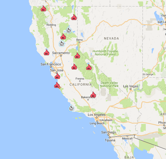 Wildfires
Since the beginning of 2016, a total of 6,193 wildfires have burned about 617,427 acres across the state. The fires have spread by 87,000 acres, or 17%, over the last two weeks. Currently, the Soberanes Fire in Los Padres National Forest is the largest active wildfire in the state, covering more than 120,000 acres. It is larger than the Gap Fire, Cedar Fire, and Rey Fire combined.
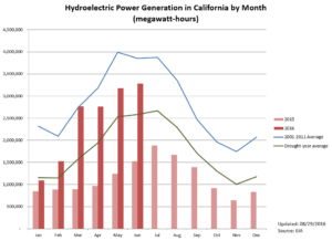 Hydropower
Hydroelectric power generation in June 2016 was about 3,300,000 MWh, more than doubling last year’s June production of 1,500,000 MWh. However, hydropower generation is still 15% less than the 2001-2011 average for the same month.
Groundwater Conditions
The most recent data on groundwater conditions are based on measurements taken in spring 2016. Maps of spring and fall groundwater level changes can be found here. Parts of the Tulare Lake, the South Coast, and the Colorado River hydrologic regions have experienced groundwater declines in excess of 100 feet between Fall 2011 and Fall 2015.
August 30, 2016
Looking Forward to Water Supply Alternatives
The California State Water Resources Control Board released a draft report on the feasibility of regulating direct potable reuse of recycled water. The report concludes that it is feasible to begin the process of developing regulations, but that regulations can only be adopted once certain research and knowledge gaps have been addressed. The report contains a series of recommendations, such as the formation of technical workgroups to develop uniform water recycling criteria.
Direct potable reuse (DPR) uses advanced water purification technologies to recycle wastewater and return potable water — water that is safe for drinking and food preparation — to the distribution system. The use of DPR dates back to the 1950s when the City of Chanute, Kansas adopted the technology to provide emergency water supplies during its six-year drought. More recently, Wichita Falls, Texas used DPR as an emergency measure for about 12 months in 2014/2015 to combat an extended drought.
In Other News
- A climate prediction update indicates that La Niña may not emerge this winter. According to the National Oceanic and Atmospheric Administration’s Climate Prediction Center, the probability of climate-neutral conditions (i.e., conditions near the long-term average) are now predicted at 55% to 60%. This suggests that the chance of La Niña occurring is 40% to 45%.
- California Governor Jerry Brown signed another drought bill (SB184) into law, prohibiting excessive water use during a drought emergency. Violators may face a fine of up to $500 for every unit (748 gallons) of water excessively used. SB184 also requires urban water suppliers to identify and restrict excessive use through one of two methods: the adoption of an excessive water use ordinance or the establishment of a rate structure that includes tiers, water budgets, and penalties or surcharges for excessive water use.
- Statewide water conservation for July fell to 20%, representing an 11 percentage point drop from last July’s achievement. Cumulative savings from June 2015 through July 2016 were about 1.9 million acre-feet, or 24% compared to the same period in 2013. The July results varied across the state, with some agencies (e.g., Anaheim, Malibu, and Vallejo), showing a significant decrease in conservation, and others (e.g., Sacramento, Beverly Hills, and Fresno) maintaining strong conservation efforts.
- A Stanford-led study found that human-caused greenhouse gas emissions may be driving the trends of extremely warm winter days in the western United States and extremely cold winter days in the East. The occurrence and severity of these “warm West/cool East” winter events increased significantly between 1980 and 2015. The warming of winter days will have negative effects on California, which depends on a healthy snowpack to provide about 30% of the state’s water supply.
- For the first time since the beginning of the drought in 2012, California’s agricultural revenue fell by nine billion dollars (adjusted for inflation) between 2014 and 2015, a decrease of 22%. Losses were most pronounced in dairy, rice, corn, cotton, fruit, and nut sectors. It is unclear how much of this loss is related to the drought. Overall, U.S. agricultural revenue fell by $45 billion in 2015, a decrease of 12%.
- This year, California’s cotton acreage has expanded despite the ongoing drought and last year’s drop in revenue. The 35% growth over the 2015 level pushed the total cotton acreage up to almost 220,000 acres statewide. Cotton farming is on a downward trajectory since at least 2000, when statewide planted cotton acreage was about 920,000 acres. Since then, statewide planted acreage has continued to fall by 5% annually on average.
- A new study shows a limitation of atmospheric-centric, long-term drought predictions since they overlook the reduction in plants’ water use under the high carbon dioxide conditions associated with climate change. More accurate predictions can be obtained through the use of plant-centric metrics. For example, the atmosphere-centric Palmer Drought Severity Index predicts future increases in drought stress for more than 70% of global land area. With the use of the precipitation minus evapotranspiration (P-E) measure, this area drops to 37%.
California Drought Status
 Drought Monitor
There has been no change to drought conditions over the past two weeks. Severe-to-exceptional drought extends across 43% of the state, while moderate-to-severe drought extends across an additional 41% of the state.
Precipitation
The NOAA’s new September forecast indicates that La Niña may not emerge this winter, as its chance of occurring has fallen below the 50% threshold.
Cumulative precipitation since the beginning of the water year (Oct. 1) has remained the same at near average (40 inches) in the San Joaquin River Basin, above average (57.8 inches) in the Northern Sierra region, and below average (25.8 inches) in the Tulare Lake Basin.
Reservoir Conditions
Water levels in California’s major reservoirs (representing 27.3 million acre-feet of storage) remain at 78% of the reported average for this time of year and 46% of the statewide capacity, a two percentage point decrease from two weeks ago. Conditions in particular reservoirs vary across the state, with reservoirs in the north of the state doing better than those further south. For example:
- The water level at Lake Shasta is at 106% of the historical average. Lake Oroville and Folsom Lake are at 76% and 57% of the historical average, respectively.
- The water level at the New Melones Reservoir, another major reservoir with a 2.4 million acre-feet capacity, remains at 39% of the historical average.
- The water level at the San Luis Reservoir hit its lowest level in 27 years in mid-August, and now stands at 47% of the historical average for this date.
- Lake Cachuma, which supplies water to the city of Santa Barbara and other urban areas in Southern California, is still at 7% of its capacity, or 9% of the historical average.
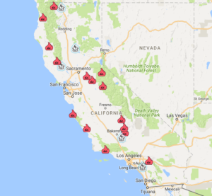 Wildfires
Since the beginning of 2016, 5,829 wildfires have burned about 529,970 acres across the state (as of 9/12/16). The fires have spread by 110,000 acres over the last two weeks. Currently, the Soberanes Fire in Los Padres National Forest is the largest active wildfire in the state, covering more than 100,000 acres. It is larger than the Gap Fire, Cedar Fire, and Rey Fire combined.
 Hydropower
Hydroelectric power generation in June 2016 was about 3,300,000 MWh, more than doubling last year’s June production of 1,500,000 MWh. However, hydropower generation is still 15% less than the 2001-2011 average for the same month.
Groundwater Conditions
The most recent data on groundwater conditions are based on measurements taken in spring 2016. Maps of spring and fall groundwater level changes can be found here. Parts of the Tulare Lake, the South Coast, and the Colorado River hydrologic regions have experienced groundwater declines in excess of 100 feet.
Additional Resources
- The California Data Exchange Center, which provides California water and weather related resources including snow surveys and rainfall maps by the California Department of Water Resources (DWR).
- “One-stop shop” for water data and maps by the National Oceanic and Atmospheric Association (NOAA).
- The Groundwater Information Center (GIC) interactive map by the California Department of Water Resources.
- River conditions by the California Nevada River Forecast Center (CNRFC).
- Interactive map of residential and system-wide water use in California by the Pacific Institute.
- Climate anomaly maps and tables for California by the Western Regional Climate Center (WRCC).
August 16, 2016
High Wildfire Danger This Season
Average global temperature in July 2016 was nearly 1.57 degrees above the 20th century average, beating the previous July record set in 2015. Dry and unstable weather conditions are contributing to a rapid increase in wildfire activity throughout California. As of August 29, there were 13 active wildfires, which had collectively burned over 260,000 acres.
The Chimney Fire in San Luis Obispo County grew by 10,000 acres in just over two days. To date, the fire has burned a total of 40,000 acres and is threatening to destroy the Hearst Castle, a state historical monument in San Simeon. The Soberanes Fire, which was started by an illegal campfire, has burned over 92,000 acres of wilderness and forest areas in Big Sur and nearby regions, making it the largest active wildfire in the state. Evacuation warnings are in effect, and nearby state parks remain closed.
Since the beginning of this year, wildfires have burned over 400,000 acres statewide. Click here to view CAL FIRE’s map of major wildfires in California.
In Other News
- The State Water Resources Control Board has authorized a zero-percent water conservation target for 337 out of 379 water service providers (or 89%) that have submitted their “stress test” results to the Board, following the new guidelines in the Board’s Emergency Conservation Regulation. About 36 water suppliers indicated that they would face a supply shortage if the drought continues and are required to set their targets equivalent to the shortfall. Informational orders were given to eight water suppliers whose submissions were incomplete, unclear, or who appeared to have not followed instructions properly.Despite the relaxed targets, certain restrictions remain in effect, such as prohibitions against using potable water to hose off sidewalks and driveways and using hoses without a shut-off nozzle to wash automobiles.
- The East Porterville Water Supply Project – a joint effort by the Department of Water Resources, the State Water Resources Control Board, and the Governor’s Office of Emergency Services – has connected the first 70 homes in East Porterville to the nearby city of Porterville’s water distribution system. East Porterville residents have relied on private domestic wells for drinking water and other uses, but the drought has caused wells to run dry or become undrinkable. As many as 1,800 homes are expected to be connected by the end of 2017.Eligible East Porterville residents who participate in the project and agree to have their property annexed by the city of Porterville will bear no connection costs, which are estimated to be at least $5,000 per connection. Once connected, property owners will be billed monthly for their water service.
- The California Water Quality Monitoring Council, consisting of the California Environmental Protection Agency, the California Natural Resources Agency, the State Water Board’s Drinking Water Program, and other relevant agencies, has recently released a new tool to track harmful algal blooms across the state. The California Harmful Algal Blooms (HABs) Portal provides timely information on reported sightings of the potentially toxic blue-green algal blooms and affected water bodies.
- Some Northern California communities, especially those reliant on a single source of surface water, are facing water shortages. For example, Paskenta, a community in Tehama County, hauled water from 20 miles away in 2014 when water levels in its creeks were too low to pump. This year, it was authorized to collect and transport up to 20,000 gallons of water daily at a cost of $5 per 1,000 gallons.
- The US Bureau of Reclamation’s August analysis of the basin’s hydrology projected that the water level in Lake Mead in January 2019 will be only a few feet above the level of 1,075-feet that would trigger water delivery curtailments on the Colorado River.
- The Board of Los Angeles Water and Power Commissioners voted to incorporate a watershed approach into their turf rebate program. In addition to limiting the use of synthetic turf and promoting native and/or climate-appropriate plants, the program also requires the use of infiltration and stormwater capture techniques, such as rain gardens and rain barrels.
California Drought Status
 Drought Monitor
There has been no change to the drought conditions over the past two weeks. Severe-to-exceptional drought extends across 43% of the state, while moderate-to-severe drought extends across an additional 41% of the state.
Precipitation
The NOAA’s August forecast suggests that the chance of La Niña occurring is 55% to 60% during the fall and winter of 2016-17. This is a decrease from the May forecast of 75%.
Cumulative precipitation since the beginning of the water year (Oct. 1) has remained the same at near average (40 inches) in the San Joaquin River Basin, above average (57.8 inches) in the Northern Sierra region, and below average (25.8 inches) in the Tulare Lake Basin.
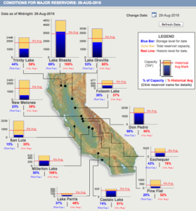 Reservoir Conditions
Water levels in California’s major reservoirs (representing 27.3 million acre-feet of storage) have fallen by 2% over the past two weeks, and reservoirs are at 78% of the reported average for this time of year and 48% of the statewide capacity. Conditions in particular reservoirs vary across the state, with reservoirs in the north of the state doing better than those further south. For example:
- The water level at Lake Shasta is at 109% of the historical average. Lake Oroville and Folsom Lake are at 80% and 57% of the historical average, respectively.
- The water level at the New Melones Reservoir, another major reservoir with a 2.4 million acre-feet capacity, has dropped slightly from 40% to 39% of the historical average.
- The water level at the San Luis Reservoir hit its lowest level in 27 years in mid-August, and now stands at 34% of the historical average for this date.
- Lake Cachuma, which supplies water to the city of Santa Barbara and other urban areas in Southern California, dropped to only 7% of its capacity, or 10% of the historical average.
 Wildfires
Since the beginning of 2016, 5,275 wildfires have burned about 413,487 acres across the state. Notably, the Soberanes Fire in the Big Sur region, the Blue Cut Fire in the San Bernardino National Forest, and the Rey Fire in the Los Padres National Forest have collectively burned about 160,000 acres.
 Hydropower
Hydroelectric power generation in June 2016 was about 3,300,000 MWh, more than doubling last year’s June production of 1,500,000 MWh. However, hydropower generation is still 15% less than the 2001-2011 average for the same month.
Groundwater Conditions
The most recent data on groundwater conditions are based on measurements taken in spring 2016. Maps of spring and fall groundwater level changes can be found here. Parts of the Tulare Lake, the South Coast, and the Colorado River hydrologic regions have experienced groundwater declines in excess of 100 feet.
Read past updates here.
July 25, 2016
Building Drought Resiliency Through Groundwater Recharge
An innovative groundwater recharge program in the Pajaro Valley in southern Santa Cruz County will offer landowners rebates for collecting stormwater runoff to boost groundwater levels in the region. Financial incentives are in the range of $9,500 to $11,750 a year for landowners capturing and infiltrating at least 100 acre-feet of stormwater at qualified project sites. As not all stormwater captured is recoverable, the rebate is priced at 50% of the the Pajaro Valley Water’s unit water cost. This five-year pilot program, also known as Recharge Net Metering, is expected to begin in October 2016.
Earlier in July, a Stanford study published in San Francisco Estuary and Watershed Science revealed that groundwater recharge and storage is one of the most cost-effective ways to increase water supplies, with a median cost of $410 per acre-foot. This managed aquifer recharge (MAR) approach may include co-benefits, such as flood control, improved water quality, and wetland habitat protection.
In Other News
- After the revised conservation rule took effect, statewide water conservation fell to 21.5% in June compared to June 2013. Statewide average residential water use was about 105 gallons per capita per day (GPCD), up from 98 GPCD for June of last year. The State Water Board is currently reviewing the water utilities’ conservation targets, which are based on self-assessments of their ability to withstand three more years of drought.
-
- San Luis Reservoir, the nation’s largest off-stream reservoir, has hit its lowest water level in 27 years, dropping to 10% of August’s historical average. The reservoir receives water from the California Aqueduct and serves as a key part of Silicon Valley’s water supply. Due to the drought, water is being held upstream to maintain cold water for endangered fish species and to control salinity levels in the Delta rather than being diverted into the San Luis Reservoir.
-
- The California Regional Water Quality Control Board has issued multiple warnings of toxic blue-green algae in lakes and waterways. Some of the affected areas include Mountain Meadows Reservoir, San Luis Reservoir and the O’Niell Forebay, Lake Britton, and the Pit River Arm of Shasta Lake.
-
- The plan to open the Santa Barbara Desalination Plant was postponed to early 2017 as a result of newly discovered issues with soil contamination as well as technical issues with power supply plans. The facility was initially mothballed in 1992 after an earlier drought ended. The estimated capital costs of reactivation are $61 million, financed over 20 years with a 1.6% interest rate loan. Annual operating costs are estimated to be about $4.1 million at full production and about $1.4 million in non-operating mode.
-
- An Orange County judge has ruled that a local water district may increase monthly water rates as an emergency measure to offset revenue declines during the drought. Judge Robert J. Moss added that such action is not subject to repeal through the referendum process. The case began with Yorba Linda Water District’s attempt to raise monthly residential rates by $25 as its revenues had declined significantly due to water conservation.
-
- The National Marine Fisheries Service and the US Fish and Wildlife Service will re-examine the nearly decade-old environmental regulations over the Delta water pumps, as some experts have suggested that they have been ineffective in protecting endangered species during this unprecedented drought. The review is expected to take at least two years.
-
- The construction of a 31,000 sq.ft. aquatic center in Dublin, Alameda County, is moving ahead despite the drought. The park is scheduled to open in February 2017. The city and water district officials maintained that the region has sufficient supplies to meet residents’ domestic and recreational water needs. However, a delay in filling the water park would be authorized should the water situation change.
California Drought Status
Drought Monitor
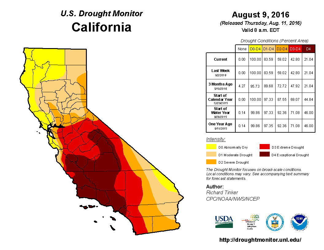 Drought conditions have remained unchanged over the past two weeks. Severe-to-exceptional drought spans 43% of the state, while areas under moderate-to-severe drought represent 41% of the state.
Any changes to California’s drought conditions are highly unlikely as the region is normally warm and dry during the summer months.
Precipitation
The latest forecast suggests that the chance of La Niña occurring is 55 to 60% during the fall and winter of 2016-17. This is a decrease from the May prediction of 75%.
Cumulative precipitation since the beginning of the water year (Oct 1) in the San Joaquin River Basin, the Northern Sierra region, and Tulare Lake Basin was the same as three weeks ago, at near average (40 inches), above average (57.8 inches), and below average (25.7 inches), respectively.
Reservoir Conditions
Over the past three weeks, water levels in California’s major reservoirs (representing 27.3 million acre-feet of storage) fell from 58% to 50% of statewide capacity. This storage level of 13.6 million acre-feet represents 79% of reported average for August 15. Lake Oroville, Shasta Lake, and Folsom Lake are now at 84%, 109%, and 60% of historical average, respectively. The water level in the New Melones Reservoir, another major reservoir with a 2.4 million acre-feet capacity, is at 40% of historical average.
San Luis Reservoir, at 10% of August’s historical average, has hit its lowest water level in 27 years.
Wildfires
Since the beginning of 2016, a total of 4,855 incidents of wildfire have burned about 270,744 acres across the state. Wildfires in Southern California average 88.4 acres per fire, five times larger than those in Northern California on average.
Hydropower
Hydroelectric power generation in May 2016 was about 3,200,000 MWh, more than doubling last year’s May production of 1,200,000 MWh. Despite this increase, it is still lower than the May 2012 production and 20% less than the 2001-2011 average for the same month.
Groundwater Conditions
The most recent data on groundwater conditions are based on measurements taken in spring 2016. Maps of spring and fall groundwater level changes can be found here. Parts of the Tulare Lake, the South Coast, and the Colorado River hydrologic regions have experienced groundwater declines of more than 100 feet.
Read past updates here.
Additional Resources
- The California Data Exchange Center, which provides California water and weather related resources including snow surveys and rainfall maps by the California Department of Water Resources (DWR).
- “One-stop shop” for water data and maps by the National Oceanic and Atmospheric Association (NOAA).
- The Groundwater Information Center (GIC) interactive map by the California Department of Water Resources.
- River conditions by the California Nevada River Forecast Center (CNRFC).
- Interactive map of residential and system-wide water use in California by the Pacific Institute.
- Climate anomaly maps and tables for California by the Western Regional Climate Center (WRCC
July 11, 2016
Algal Bloom in California’s Lakes
Drought-related factors, such as warmer temperatures, reduced flows, and high nutrient concentrations, have caused a number of toxic algal blooms across California. Since early summer, local officials have warned against human and animal contact with or use of untreated water in several Northern California water bodies, including the Iron Gate and Copco Reservoirs on the Klamath River and Lake Temescal in Oakland. The problem is becoming more widespread, with a series of warnings in July. The affected lakes and reservoirs include Pyramid Lake in Los Angeles County and the Pit River Arm of Shasta Lake and Lake Britton in Shasta County.
The blue-green algae, or cyanobacteria, produce toxins that can harm human health. Exposure from skin contact, swallowing, or inhaling the spray can cause rashes, mouth ulcers, vomiting, diarrhea, and cold- or flu-like symptoms. Common water purification techniques, such as camping filters, tablets, and boiling do not remove toxins. Officials have also warned against eating fish and clams from the affected water bodies and permitting pets to swim in the water or drink it.
In Other News
- The California Department of Public Health reported an increase in West Nile Virus (WNV) activity across the state. While the first human case has not been confirmed, a resident of Los Angeles County has symptoms consistent with West Nile Virus disease. Some public health officials and scientists have suggested that the drought may be linked to a rise in WNV prevalence; reduced flows create pools of stagnant water, and limited water sources leads to more interactions between birds and WNV-carrying mosquitoes.
- The latest El Niño-Southern Oscillation forecast suggests a reduction in the probability of La Niña developing during the fall and winter of 2016-17. The current prediction shows a 55-60% chance, compared to the 75% chance predicted in May 2016.
- Stanford researchers recently published a new study that highlights the costs and benefits of using groundwater recharge and storage across the state. The study reveals that the median cost of managed aquifer recharge (MAR) projects is $410 per acre-foot, compared to the more expensive surface water projects, which have a median cost of $2,100 per acre-foot.
- The US House of Representatives passed the Interior and Environmental Appropriations bill for fiscal year 2017 (H.R. 5538), providing $32 billion in funding for various government and related agencies. The bill includes several California drought relief provisions, such as an increase in State Water Project deliveries and financial assistance for affected communities. The bill has been passed on to the Senate for further action.
- The US Bureau of Reclamation has increased Class I water supply allocation for Friant Division contractors to 75%. The initial allocation announced in April was 30% and was subsequently increased three times before the current amount was settled upon. This increase was made possible by an agreement between Friant Division contractors and others to exchange water from the east side of the San Joaquin Valley.
- An investigation by the Desert Sun showed an 8% decrease in water use by golf courses in Coachella Valley during the 12-month period between June 2015 and May 2016, compared to the same months in 2013. While imports from the Colorado River rose by 36% in that period, the overall decrease of 8% was made possible by reductions in groundwater use.
- A new report by the Xerces Society, entitled “State of the Monarch Butterfly Overwintering Sites in California,” highlights that the population of monarch butterflies overwintering along the California coast has declined by 74% in less than two decades. Important factors influencing the decline include the loss of habitat, the widespread use of insecticides, and the increased frequency of drought.
- The California Natural Resources Agency recently launched the Delta Smelt Resiliency Strategy, a science-based document to guide voluntary efforts by state and federal agencies engaging in the Delta Smelt conservation. The document outlines several actions, including releasing water into the Yolo Bypass to boost zooplankton production, removing invasive aquatic weeds in important smelt habitat, and increasing outflows to the Pacific Ocean in order to improve smelt habitat. The endangered fish have come close to extinction after several months of extremely dry weather.
- Researchers at the University of California, Riverside have launched a new study to examine the impacts of the California drought on public health. The two-year project will examine the influence of drought-related water deliveries on health impacts for residents in California’s poorest regions.
- The Department of Water Resources reported that 94% of the state’s 127 high- and medium-priority groundwater basins are fully monitored and more than 1.5 million groundwater elevation measurements from across the state have been entered into the California Statewide Groundwater Elevation Monitoring Program (CASGEM), which is managed by the DWR in partnership with local water districts. By tracking seasonal and long-term groundwater elevation trends, the program provides fundamental information to improve groundwater management in California.
California Drought Status
Drought Monitor
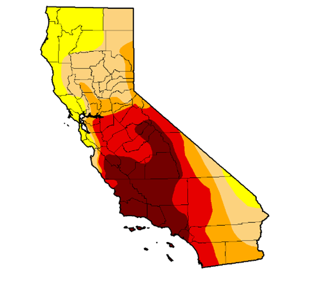 Drought conditions have remained unchanged over the past two weeks. Severe-to-exceptional drought spans 43% of the state, while areas under moderate-to-severe drought represent 41% of the state.
Any changes to California’s drought conditions are highly unlikely as the region is normally warm and dry during the summer months. However, the short-term outlook suggests a high chance of above normal temperatures in the coming week.
Precipitation
Cumulative precipitation since the beginning of the water year (Oct 1) in the San Joaquin, Northern Sierra, and Tulare Lake Basin are the same as two weeks ago, at near average (40 inches), above average (57.8 inches), and below average (25.7 inches), respectively.
Reservoir Conditions
Over the past two weeks, water levels in California’s major reservoirs (representing 27.3 million acre-feet of storage) slightly fell from 60% to 58% of statewide capacity. This storage level of 15 million acre-feet represents 82% of reported average for July 22. Lake Oroville, Shasta Lake, and Folsom Lake are now at 94%, 109%, and 77% of historical average, respectively. Water levels in the New Melones Reservoir, another major reservoir with a 2.4 million acre-feet capacity, declined slightly over the past two weeks to 40% of historical average.
Wildfires
Since the beginning of 2016, a total of 3,801 incidents of wildfire have burned about 123,011 acres across the state. Wildfires in Southern California average 44 acres per fire, 2.4 times larger on average than those in Northern California.
[Note: these was an error in an earlier report (July 8, 2016) by the National Interagency Fire Center, which showed that year-to-date wildfires had affected about 180,000 acres across California.]Hydropower
Hydroelectric power generation in April 2016 was about 2,760,000 MWh, nearly tripling last year’s April production of 970,000 MWh. The current level is the highest for an April hydroelectric power generation since 2011, but it is still 13% less than the 2001-2011 average for April.
Groundwater Conditions
The most recent data on groundwater conditions are based on measurements taken in spring 2016. Maps of spring and fall groundwater level changes can be found here. Parts of the Tulare Lake, the South Coast, and the Colorado River hydrologic regions have experienced groundwater declines of more than 100 feet.
Read past updates here.
Additional Resources
- The California Data Exchange Center, which provides California water and weather related resources including snow surveys and rainfall mapsby the California Department of Water Resources.
- “One-stop shop” for water data and maps by the National Oceanic and Atmospheric Association (NOAA).
- The Groundwater Information Center (GIC) interactive map by the California Department of Water Resources.
- River conditions by the California Nevada River Forecast Center (CNRFC).
- Interactive map of residential and system-wide water use in California by the Pacific Institute.
- Climate anomaly maps and tables for California by the Western Regional Climate Center (WRCC)
July 8, 2016
Mixed Messages About the Drought
Statewide water conservation increased from 26.1% in April to 28.2% in May 2016 (compared to the same months in 2013). However, in response to opposition from local water suppliers and improved supply conditions, the State Water Resources Control Board has replaced a percentage-based conservation target with a self-certified target. Termed “a stress test” approach, the new standard requires water suppliers to determine potential water shortages if the drought continues for three additional years. Any shortfalls would require suppliers to conserve at least the same amount. Under the revised emergency regulation, nine of the 10 largest urban water suppliers have set their conservation targets at zero, claiming that they expect no shortage if drought conditions persist. The State Water Board is now reviewing conservation target submissions and will make them publicly available in the coming weeks.
Meanwhile, evidence of the drought’s persistence continues to emerge. The US Forest Service recently announced that 66 million trees have died across California between 2010 and mid-2016. The historic level of die-offs greatly increases the risk of catastrophic wildfires in the summer and early fall. Moreover, a new study, based on a probabilistic simulation of 65 years of data, revealed that the Sierra Nevada snow-pack may take four years to recover from the drought.
In Other News
- State agencies are working with Tulare County local governments and nonprofit agencies to connect 40 homes in East Porterville to the City of Porterville’s existing water distribution lines. The second phase of the project will include the placement of a transmission line along East Porterville streets to connect an additional 460 homes. The remaining 1,300 homes with contaminated wells are scheduled to be connected to the new system by the end of 2017.
- On June 20, the California Independent System Operator (California ISO) issued a Flex Alert, a call for energy conservation, in the Southern California region as a severe heatwave set record high temperatures in many cities. Energy demand continued to spiral, leading to blackouts in thousands of homes in Los Angeles the following day.
- Scientists have found that wind, rather than the amount of evaporated moisture in the air, is the main driver of droughts in California. The study, published in Geophysical Research Letters, may eventually help to better forecast droughts and floods by identifying key predictors of rainfall.
- A new map by NASA’s Jet Propulsion Laboratory shows the devastating impacts of the California drought on Sierra Nevada conifer forests. The US Forest Service will use this map to assess and respond to areas with high fire risks, by taking action such as conducting prescribed burning.
- Stanford University scientists estimated that the Central Valley has three times more groundwater in deep aquifers than previously estimated. However, access may not be economically feasible and safeguarding it could be a challenge; it could take hundreds to thousands of years to replenish. In another report, scientists pointed out that there are still large uncertainties about groundwater due to the lack of data.
- The California Department of Housing and Community Development awarded $150,000 to assist rural residents who lack access to potable water in Yolo County. The Drought Housing Relocation Assistance program enables eligible households, renters, and homeowners to relocate and receive rental assistance for 12 months.
- The Bureau of Reclamation increased reservoir water releases below Nimbus Dam into the Lower American River from 4,000 cubic feet per second (cfs) to 4,500 cfs on July 1, and then to 5,000 cfs on July 5. The increases are based on the Sacramento-San Joaquin Delta water quality requirements, the Delta outflow requirements, and the Central Valley Project deliveries.
- The US Bureau of Reclamation has selected five projects across California to receive a total of $2.9 million in CALFED Water Use Efficiency grants. These projects are expected to conserve about 10,275 acre-feet of water per year.
- The California Senate Committee on Governance and Finance approved a bipartisan bill, AB 2551, which aims to facilitate the development of surface storage projects, such as the Sites Reservoir and Temperance Flat Dam projects. The bill has passed to the Senate Appropriations committee for further consideration.
California Drought Status
Drought Monitor
There has been little change in drought conditions over the past two weeks. Severe-to-exceptional drought regions span 43% of the state, while areas under moderate-to-severe drought fell slightly to 41%.
According to the US Drought Monitor, any changes to California’s drought conditions are highly unlikely as the region is normally warm and dry during the summer months.
Precipitation
The Sierra snowpack has completely melted off in reporting station areas. The snowpack plots suggest that the snow-water content fell to zero around mid-June, about two weeks earlier than in an average year.
Cumulative precipitation in the San Joaquin, Northern Sierra, and Tulare Lake Basin are the same as two weeks ago, at near average (40 inches), above average (57.8 inches), and below average (25.7 inches), respectively.
Reservoir Conditions
Over the past two weeks, water levels in California’s major reservoirs (representing 27.3 million acre-feet of storage) slightly fell from 64% to 60% of statewide capacity. These levels represent 83% of reported average for July 7. Lake Oroville, Shasta Lake, and Folsom Lake are now at 100%, 108%, and 85% of historical average, respectively. New Melones Lake, another major reservoir with a 2.4 million acre-feet capacity, decreased slightly over the past two weeks to 41% of historical average.
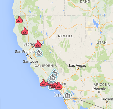
Wildfires
Since the beginning of 2016, wildfires have burned about 185,000 acres across the state, totaling 2,015 incidents. The average size of wildfires in southern California is about 224 acres per fire, or 10.7 times the size of those in northern California.
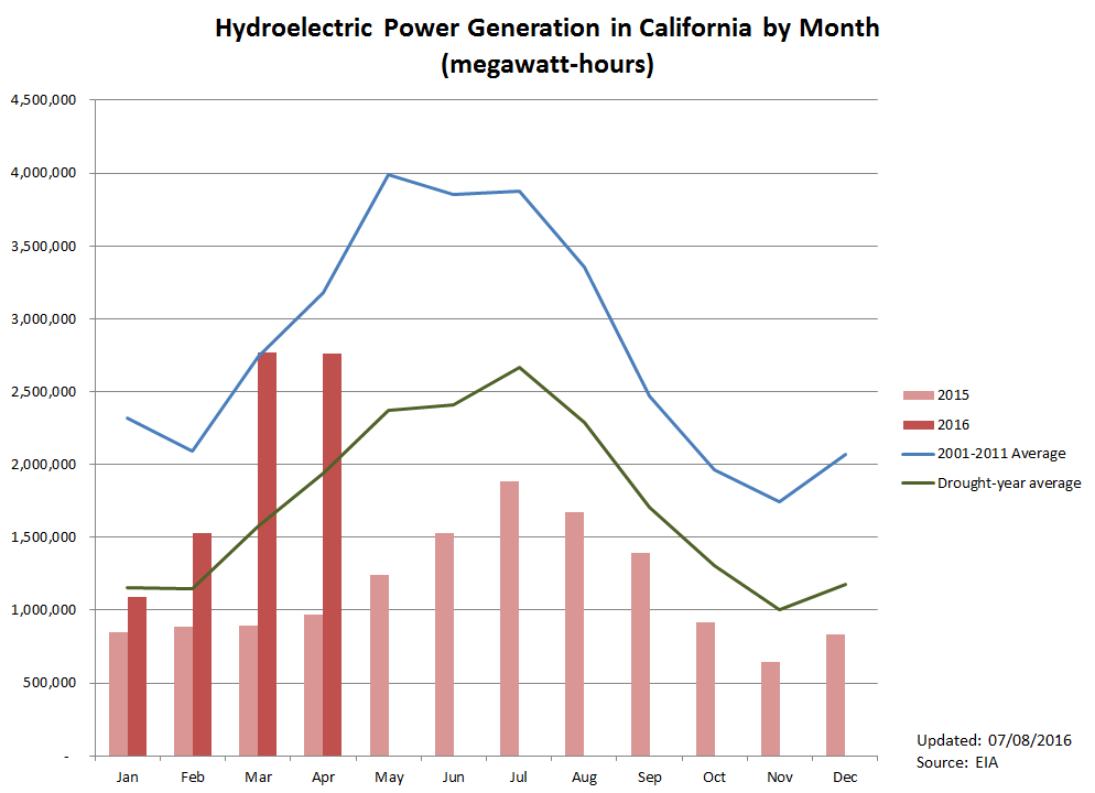
Hydropower
Hydroelectric power generation in April 2016 was about 2,760,000 MWh, almost tripling last year’s production of 970,000 MWh. The current level is the highest for an April hydroelectric power generation since 2011. However, it is still 13% less than the 2001-2011 April average.
Groundwater Conditions
The most recent data on groundwater conditions are based on measurements taken in spring 2016. Maps of spring and fall groundwater level changes can be found here and a map highlighting significant changes is available here. Areas with the greatest concern, where groundwater levels have declined by more than 100 feet, are found in parts of the Tulare Lake, the South Coast, and the Colorado River hydrologic regions.
Read past updates here.
Additional Resources
- The California Data Exchange Center, including a water supply and drought information summary, by the California Department of Water Resources.
- “One-stop shop” for water data and maps by the National Oceanic and Atmospheric Association (NOAA).
- The Groundwater Information Center (GIC) interactive map by the California Department of Water Resources.
- Interactive tool of changes in reservoir storage levels since January 2010 by KQED News.
- River conditions by the California Nevada River Forecast Center.
- Interactive map of residential and system-wide water use by the Pacific Institute.
- The Western Regional Climate Center’s (WRCC) climate anomaly maps and tables for California.
June 21, 2016
Potentially One of the Worst Wildfire Seasons Ahead
The National Interagency Fire Center predicts that the ongoing drought will significantly increase fire potential, especially in Southern California. In an effort to mitigate risk, the Los Padres National Forest recently increased fire restrictions to Level III, which prohibits wood and charcoal fires in all areas of Los Padres National Forest except for developed campgrounds. Earlier in June, the Calabasas fire, which consumed more than 500 acres, prompted an evacuation of about 5,000 people in the Topanga Canyon and Mulholland Highway area around Calabasas.
Currently, California is experiencing three large fires (as of June 20, 2016):
- The Sherpa fire in Los Padres National Forest is affecting 7,893 acres, and is 54% contained.
- The Pony fire in Klamath National Forest is spreading across 2,855 acres, and is 60% contained.
- The Soda fire in San Luis Obispo County is affecting 2,005 acres, and is 95% contained.
California will likely experience a more active fire season this year. Cal Fire has estimated that drought and bark beetle infestation have caused the death of over 29 million trees, an increase from 3.3 million trees in 2014 (water-starved trees are especially vulnerable to drought beetle infestation). These dead and dying trees increase the risk of fire across the state.
In Other News
- The State Water Resources Control Board dismissed fines for unauthorized water diversions they had levied on Byron-Bethany Irrigation District and West Side Irrigation District. They cited a lack of adequate evidence to justify the cease-and-desist order as reason for the dismissal.
- California’s 3rd District Court of Appeal temporarily suspended the Metropolitan District of Southern California’s $175 million purchase of Delta islands to allow more time to consider evidence. San Joaquin and Contra Costa counties requested this judicial process given concerns relating to the construction of the Delta tunnels, which would convey water from the Sacramento River to Southern California.
- The Metropolitan Water District of Southern California, the region’s largest wholesale water supplier, announced that it has enough water to last for the next three years, even if the current drought continues. The analysis was a response to the State Board’s requirement to conduct a “stress test” to determine the need for conservation.
- The US Geological Survey released a new online interactive tool that provides summaries of decadal-scale changes in groundwater quality across the nation. The map highlights groundwater quality concerns in California, especially for nitrate, chloride, and total dissolved solids.
- On June 9, the National Weather Service declared that El Niño has dissipated. ENSO-neutral conditions are present with a 75% chance of La Niña development during the upcoming fall and winter. ENSO-neutral conditions refer to periods when the ocean temperatures, tropical rainfall patterns, and atmospheric winds over the equatorial Pacific Ocean are near the long-term average.
- The State Board reported that water conservation increased to 26.1% across the state in April over 2013 usage, but stressed that water suppliers must continue to make conservation a top priority amidst ongoing drought conditions in many parts of California.
- Scientists at the University of California’s West Side Research and Extension Center found that, for some crops, overhead irrigation systems can produce the same or increased yield as furrow or drip irrigation. Overhead irrigation systems are currently only used on about 2% of California’s irrigated acreage.
- San Joaquin County’s groundwater report to the Advisory Water Commission reveals that water levels in that county have dropped about two feet on average over spring 2016, less than the 3-foot drop experienced in spring 2015.
California Drought Status
Drought Monitor

The severity of drought conditions has remained relatively the same over the past two weeks. About 43% of the state is under severe-to-exceptional drought, similar to two weeks ago. Areas under moderate-to-severe drought are about 42%.
The state’s water supply may appear to be in a good condition at the moment, but rapid snowmelt may affect supplies later in the summer.
Precipitation
The Sierra snowpack is at 6% of normal as of its normal level as of June 13, a decrease of 17 percentage points since June 1. The Central and Southern Sierra reporting stations are now clear of snow. See these snowpack plots for changes over time.
Cumulative precipitation is still about average in the San Joaquin region, at 40 inches since the beginning of the water year (October 1), and above average in the Northern Sierra region at 57.8 inches. However, cumulative precipitation is currently below average in the Tulare Lake Basin at 25.7 inches.
Reservoir Conditions
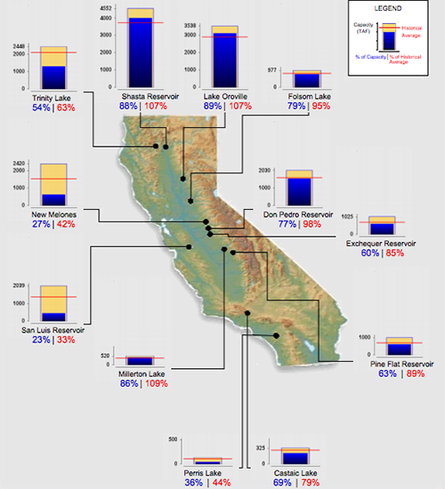 Over the past two weeks, water levels in California’s major reservoirs (representing 27.3 million acre-feet of storage) slightly fell to 64% of statewide capacity. These levels represent 86% of reported average for June 5. Lake Oroville, Shasta Lake, and Folsom Lake are now at 107%, 107%, and 95% of historical average, respectively. However, New Melones Lake, another major reservoir with a 2.4 million acre-feet capacity, remains at 42% of historical average.
Groundwater Conditions
The most recent data on groundwater conditions are based on measurements taken in fall 2015. Maps of spring and fall groundwater level changes can be found here and a map highlighting significant changes is available here. Areas with the greatest concern, where groundwater levels have declined by more than 100 feet, can be found in parts of the Tulare Lake, the South Coast, and the Colorado River hydrologic regions.
June 7, 2016
Groundwater Conditions and Drought Response
California has experienced one of the driest four-consecutive years (2012-2015) in the past century. While the current water year is considered to be dry to normal, depending on location, prolonged drought conditions and legacy problems have resulted in continued reduction in groundwater supplies, and in some cases, permanent impacts on aquifers due to land subsidence.
Earlier last year, Governor Jerry Brown approved a $1 billion emergency drought relief package, which allowed the State Water Resources Control Board (State Water Board) to provide more funding for the emergency drinking water program. The State Water Board has now set aside $19 million dollars to provide bottled water to disadvantaged communities as well as to rehabilitate wells and drill new wells.
In Fresno County, dwindling groundwater supplies means agricultural and domestic water users must drill deeper into existing wells or tap into new wells. Over 960 wells for irrigated agriculture and 760 wells for domestic use were newly drilled or replaced in 2015, compared to a total of 320 wells in 2010. The cost of drilling domestic wells is approximately $40 per foot, while it can be as high as $200-$300 per foot for agricultural wells that are 700-1,000 feet deep, according to an environmental health specialist from the Department of Public Health.
Other News
- A new study on land-use change in California finds that urbanization will be the primary cause of greater water demand in the state. Tamara Wilson, researcher from the US Geological Survey, explains that the state will likely see a 4% overall increase in water demand in 2062 compared to 2012.
- Recent analysis by researchers from the University of California, Davis, estimates that the water conservation mandate during the drought saved 920 gigawatt-hours and reduced greenhouse gas (GHG) emissions by 220,000 metric tons of carbon dioxide equivalent between June 2015 and February 2016.
- The City of San Francisco has issued the first certified green bond under the Water Climate Bonds Standards. The bond will help fund projects to repair the city’s aging water infrastructure, including stormwater and sewer systems.
- The easing of California’s drought has boosted the state’s early spring generation of hydroelectricity to its highest level since 2011. According to the US Energy Information Administration (EIA), net generation for hydroelectricity in March 2016 was about 2,800 gigawatt-hours, compared to 900 gigawatt-hours in the same month last year.
- The US House of Representatives added 806 pages of amendments to the Senate energy bill, S. 2012, the Energy Policy Modernization Act of 2016, including Congressman David Valadao’s (R-CA 21) drought relief bill, which passed the house in July 2015 and which President Obama has already said he would veto.
- The Board of Directors of The East Valley Water District (EVWD), in San Bernardino County, has approved a $2 million contract to replace existing meters with new “smart meters” that will monitor water use in real-time and help to improve local water conservation efforts. The project will be funded by a loan granted by the Department of Water Resources (DWR).
- The State Water Resources Control Board (State Water Board) is proposing to dismiss a $1.5 million fine to be levied against the Byron-Bethany Irrigation District, in Contra Costa County, for unauthorized diversions in the Sacramento and San Joaquin River watersheds after an issuance of a water unavailability notice. The draft order to dismiss will also apply to a similar enforcement action filed against the West Side Irrigation District, in San Joaquin County. The Board of Directors of the Pajaro Valley Water Management Agency has approved a program for Recharge Net Metering (ReNeM), a first of its kind in California and part of a comprehensive effort to improve groundwater conditions in the Valley. ReNeM will create financial incentives for landowners to infiltrate stormwater and replenish aquifers.
- A new study by the US Geological Survey and National Park Service shows that thinning forests with prescribed fire can reduce the effects of the drought. Researchers studied low elevation conifer forests in areas that had recently experienced severe drought in Sequoia, Kings Canyon, and Yosemite National Parks. They found greater tree mortality in forests that were not burned before the onset of the drought in 2012.
- A new report by the Stanford Woods Institute for the Environment finds that increasing freshwater supplies through desalination may be important to specific coastal communities, but the technology is unlikely to significantly alter the basic water budget in California due to its high cost, high energy demands, and other factors.California’s 4th District Court of Appeals upheld plans for the Cadiz Water Project, a proposed, long term transfer of Mojave Desert groundwater to cities in Southern California. The project would deliver an average of 50,000 acre-feet of water per year for 50 years.
- A new mapping tool by the US Geological Survey reveals that nitrate concentrations are rising in some areas in the Central Valley, while arsenic levels remain relatively constant and are decreasing in some areas.
California Drought Status
Drought Monitor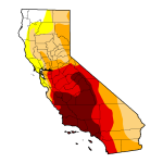
Drought conditions have improved quite drastically over the last two weeks. 43% of the state is now under severe-to-exceptional drought, decreasing from 63% in mid-May. About 6% is deemed drought-free.
Precipitation
The Sierra snowpack is now at 23% of normal, as of June 1. This represents a decrease of 6 percentage points from two weeks ago. See these snowpack plots for changes over time.
Cumulative precipitation is still about average in the San Joaquin region, and above average in the Northern Sierra region. However, it is currently below average in the Tulare Lake Basin.
Reservoir Conditions
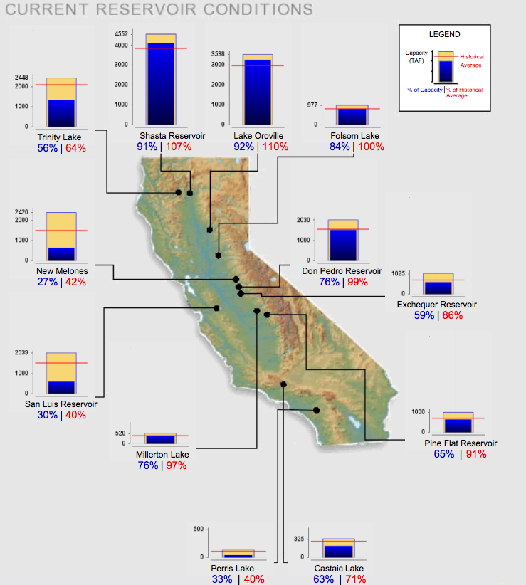 Water levels in California’s major reservoirs (representing 27.3 million acre-feet of storage) slightly dipped to 66% of statewide capacity. These levels represent 87% of reported average for June 5. Lake Oroville, Shasta, and Folsom, are now at 110%, 107%, and 100% of historical average, respectively. However, New Melones, another major reservoir with a 2.4 million acre-feet capacity, is currently at 42% of historical average.
Groundwater Conditions
The most recent data on groundwater conditions are based on measurements taken in the fall 2015. Maps of spring and fall groundwater level changes can be found here and a map highlighting significant changes is available here. Areas with the greatest concern, such as areas where groundwater levels have declined by more than 100 feet, can be found in parts of the Tulare Lake, South Coast, and Colorado River hydrologic regions.
Hydropower
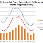 Hydroelectric power generation in March 2016 was about 2,770,000 MWh, tripling last year’s production. The current level is the highest since 2011.
May 24, 2016
Statewide Conservation Rules Lifted, Responsibility Transferred to Local Agencies
On May 9, Governor Jerry Brown reaffirmed drought regulations are to remain in effect, and directed state agencies to transition policies to permanent, long-term improvements of water use. Under Executive Order B-37-16 (Making Water Conservation a California Way of Life), bans on wasteful use of water, such as hosing down driveways or watering lawns within 48 hours of a rainstorm, are to remain indefinitely. Urban water suppliers are permanently required to issue monthly water usage reports and agricultural water suppliers with over 10,000 irrigated acres of land are required to complete Agricultural Water Management Plans to prepare for dry periods.
Following Governor Brown’s executive order, the State Water Resources Control Board suspended the February 2016 extended urban water conservation regulation, and instead, adopted a “stress test” approach to conservation that allows local water agencies to set their own targets. The new targets will be based on current supply conditions and the projected shortfall that would be expected if the drought were to continue for three more years. The new regulation keeps in place monthly conservation reporting, specific prohibitions against certain water uses, and prohibitions against homeowners associations taking actions against homeowners’ conservation practices during a declared drought period.
California’s historic drought is far from over and La Niña is looming. Yet the new regulations will most likely result in many water agencies reducing their targets; in some cases, these targets are expected to be reduced to zero. The City of Riverside announced it will lift its conservation target, citing that supplies within its carefully managed groundwater basin are sufficient for another 20 years. Similarly, Placer County Water Agency also pointed to their excess supply available to meet future growth. Metropolitan District of Southern California anticipates a reduction in water conservation targets for its 26 member agencies.
In other news…
- The chances that El Niño will transition into La Niña have increased to 75% for this fall.
- The California State Senate approved SB 814, which was introduced by Senator Jerry Hill (D-San Mateo), to require every water district to create a process for identifying and penalizing heavy water users during drought emergencies. The bill must be approved by the state assembly and Governor Brown before becoming law.
- The California Water Commission approved regulations to guide local agencies in the development of their sustainable groundwater management plans. These regulations, produced by the Department of Water Resources (DWR), reflect DWR’s responsibility under the Sustainable Groundwater Management Act (SGMA).
- The California Department of Public Health released survey results on drought impacts on residents in East Porterville and Cutler-Orosi, in Tulare County. A third of all surveyed households responded that the drought was responsible for decreased household income and nearly half of the respondents in East Porterville and a third in Cutler-Orosi indicated that the drought had negatively affected their peace of mind.
- The Board of Directors of the Pajaro Valley Water Management Agency has approved a program for Recharge Net Metering (ReNeM), a first of its kind in California and part of a comprehensive effort to improve groundwater conditions in the Valley. ReNeM will create financial incentives for landowners to infiltrate stormwater and replenish aquifers.
- The San Bernardino Valley Municipal Water District and the East Valley Water District announced a joint purchase of land for the location of a new wastewater treatment plant. The Sterling Natural Resource Center will treat wastewater to produce 18 million gallons of water per day for groundwater recharge. It is slated to cost $128 million.
- California’s 4th District Court of Appeals upheld plans for the Cadiz Water Project, a proposed, long term transfer of Mojave Desert groundwater to cities in Southern California. The project would deliver an average of 50,000 acre-feet of water per year for 50 years.
- The USDA Forest Service and partners are gearing up for a significant 2016 wildfire season. Wildfires this year could be catastrophic as the drought and other contributing factors have left 40 million trees dead, including 29 million that died in 2015.
- Sudden oak death disease that has killed more than three million trees in California’s coastal forests may become more widespread. The drought had slowed the disease’s spread considerably, but the incidence may increase after recent storms, as rain provides an ideal condition for bacterial growth.
- Last year’s drought conditions severely impacted San Luis Obispo County’s wine grape production and cattle farming, causing a 31% drop in wine grape production and over 50% reduction in cattle sales, compared to 2014. However, strawberry production received a boost from dry weather and sales continued to climb, making it the county’s leading crop in sales value at $222.6 million.
- A report by San Diego Coastkeeper shows that the continuing drought may be degrading inland water quality. Urban runoff, sewage, and industrial pollution also remain serious problems.
- The Scotts Valley Water District in Santa Cruz County will reopen its recycled water fill station to provide up to 250 gallons per day of free recycled water for residential landscape irrigation. The fill station is opened two days per week.
- Water levels at Lake Mead, the nation’s largest reservoir, have hit a new record low at 1,073 feet. The US Bureau of Reclamation anticipates the level will drop another two feet through the end of June. If it drops to 1,045 feet, California would start its voluntary reduction of 200,000 acre-feet a year, with an additional 50,000 acre-feet for every five-foot drop beyond this level.
- The World Bank’s recent report finds that water scarcity, exacerbated by climate change, could cost some regions up to 6% of their GDP by 2050 and increase the likelihood of conflicts. Climate change will affect the distribution of water across countries and make some nations much worse off.
California Drought Status
Drought Monitor
Drought conditions continue to improve slightly over the last two weeks. While 63% of the state is still under severe-to-exceptional drought as of May 17, 5.5% is deemed drought-free, an improvement from 4.3% two weeks ago.
Precipitation
The Sierra snowpack is diminishing rapidly. As of May 23, statewide snow-water content is 29% of average, down from 57% two weeks  ago. See these snowpack plots for changes over time.
Cumulative precipitation is still about average in the San Joaquin region, and above average in the Northern Sierra region. However, it is currently below average in the Tulare Lake Basin.
Reservoir Conditions
Recent storms and melting snow have led water levels in California’s major reservoirs (representing 27.3 million acre-feet of storage) to increase to 67% of statewide capacity, compared to 65% two weeks ago. These levels represent 89% of reported average for May 24. Lake Oroville, Shasta, and Folsom, are now at 113%, 107%, and 106% of historical average, respectively. However, New Melones, another major reservoir with a 2.4 million acre-feet capacity, is currently at 41% of historical average.
Groundwater Conditions
The most recent data on groundwater conditions are based on measurements taken in the fall 2015. Maps of spring and fall groundwater level changes can be found here and a map highlighting significant changes is available here. Areas with the greatest concern, such as areas where groundwater levels have declined by more than 100 feet, can be found in parts of the Tulare Lake, South Coast, and Colorado River hydrologic regions.
May 10,2016
Water Conservation Continues, But With a Twist
The State Water Resources Control Board (the State Board) recently released a proposal to amend the extended emergency water conservation regulations (adopted February 2, 2016) due to improvements in water supply conditions throughout the state. Significant proposed changes include replacing statewide standards with locally developed conservation targets. Individual urban water suppliers would be required to self-certify that they have sufficient water supplies and to reduce potable water use in a percentage equal to their projected shortfall, assuming three additional years of drought. A technical fact sheet of the proposal can be found here. Public comments are accepted until May 16, and the revised regulations are set for consideration on May 18, 2016.
Meanwhile, water agencies that were fined last October for not meeting mandatory conservation targets have been working with the State Board to come up with an agreement on how those fines will be spent. The Coachella Valley Water District and the Indio Water Authority have reached deals with the State Board to invest the money locally to promote water efficiency programs. The Coachella Valley Water District plans to use its $61,000 fine to start a certification course on water use efficiency for landscape professionals. At the same time, the Indio Water Authority aims to use the fine to support rebate programs and to create a website that will allow customers to see real-time information about their water use, among other conservation efforts. As for the other two agencies that were fined last year, the City of Beverly Hills has paid its fine, while the City of Redlands is still in negotiation for a settlement agreement.
In other news…
— After water conservation efforts slowed in early 2016, statewide conservation improved in March, resulting in 24.3% water reduction compared to the March 2013 water use level.
— The Bureau of Reclamation announced an additional increase in water supply allocation to Class 1 Friant Division contractors from 50% to 65%. The decision was based on improved forecasted hydrologic conditions, commercial power operations in the Upper San Joaquin River Bain, current storage in Millerton Lake, and continued cooler weather demand patterns.
— Citing healthy reservoir levels from recent storms, the East Bay Municipal Water District (EBMUD) board suspended financial penalties for water users that exceed 80 units (59,840 gallons) of water per billing cycle. The agency is considering dropping drought surcharges as well. However, as of May 9, the agency remains under Stage 4 drought (a critical stage), which allows it to enforce a temporary surcharge of up to 25% and an excessive use penalty.
— The US Forest Service estimated that 27.6 million tree deaths in 2015, up from 3.3 million in 2014. Drought and the spread of bark beetles are the main causes of these tree deaths.
— The Riverbank City Council is deciding on new rules to ease water conservation and allow people to ask for permission to temporarily ignore watering rules for new plantings, concrete work, or power-washing to prepare for painting. The city adopted tough restrictions earlier in November as it struggled to reach its conservation target of 32%, having saved less than 8% between June 2015 and February 2016.
— Modesto is considering raising its water rates by as much as 63% over five years as revenue plummets during the drought. The increased water rate would also help finance infrastructure projects.
— Los Angeles water wasters will face tougher fines and water audits under a plan approved by Mayor Eric Garcetti. The City’s amended water conservation plan will fine residents between $1,000 and $40,000 a month for “unreasonable use” of water when the city is in an elevated phase of its emergency drought plan. Currently, fines on wasteful outdoor water use range from $100 to $300, but they will increase to as much as $1,200 under the new plan.
— A new Carmel River water initiative to leave Rancho Cañada golf course irrigation water in the Carmel River will likely cost Monterey-area customers $3 million through 2019. The agreement between California American Water and the Trust for Public Land also involves a conversion of 140 acres of golf course land into parks and open space. The revenue collected from these areas will go towards funding the initiative.
— The Public Policy Institute of California’s Statewide Survey shows fewer Californians think that water supply in their part of California is a big problem than in previous surveys. In the recent March survey, 57% expressed drought concerns, compared to 70% in September 2015.
— California’s 2015 almond acreage increased to 1,110,000 acres, up by 6% from 2014, according to the California Department of Food and Agriculture and USDA-National Agricultural Statistics Service. Preliminary bearing acreage for 2016 is estimated at 900,000 acres.
— The number of Sacramento River fall Chinook salmon that will be available for recreational and commercial ocean salmon fishing is expected to decline from 650,000 in 2015 to roughly 300,000 this year.
— As water levels in Lake Mead continue to drop to historical lows, California, Nevada, and Arizona water officials have been negotiating a cut in water withdrawals from the over-allocated Colorado River. The curtailment plan includes proportional cuts from the three states, although California, as the largest diverter within the Lower Colorado River Basin, may be subject to reduce its 4.4 million acre-feet allocation by 200,000 acre-feet. The Colorado River Compactof 1922 governs water allocation between these southwestern states.
— Old Hill Ranch in Sonoma Valley is practicing “dry farming”, a farming method that does not use artificial irrigation, but instead relies on soil preparation to hold on to water for drier months. Under the right conditions, this method will produce grapes that are smaller, but with a better and more intense flavor, according to the ranch’s manager.
— The California Department of Food and Agriculture announced $16 million in awards for 129 projects under its State Water Efficiency and Enhancement Program (SWEEP), which supports projects that result in on-farm greenhouse gas emissions reductions and water savings.
— CAL FIRE declared May 1-7, 2016, as “Wildfire Awareness Week”, stressing the critical role all Californians play in preparing for the fire season. Earlier in March, the state department hired an additional 400 firefighters to increase
readiness for fire prevention and response.
California Drought Status
Drought Monitor
Drought conditions are improving as many regions transition away from extreme and exceptional drought. As of May 3, some moderate drought was removed in the northwestern-most part of the state.
Precipitation
Despite recent storms, the Sierra snowpack continues to melt at an accelerated rate. The snow-water content was initially on course with an average year. However, it quickly dropped from 70% of normal a month ago to 57% as of May 9. (See these snowpack plots for changes over time).
Cumulative precipitation increased slightly in all regions over the past two weeks. Levels are close to average in the San Joaquin and the Tulare Lake Basin regions and are about eight inches above average in the Northern Sierra region.
Reservoir Conditions
Water levels in California’s major reservoirs (representing 27.3 million acre-feet of storage) slightly decreased from two weeks ago and are now at 65% of statewide capacity and 88% of group average for this date. Levels in Lake Oroville, Shasta, and Folsom are at about 117%, 102%, and 111% of historical average, respectively. However, New Melones, another major reservoir with a 2.4 million acre-feet capacity, is only at 40% of historical average.
Groundwater Conditions
Most recent data on groundwater conditions are based on fall 2015 measurements. Maps of spring and fall groundwater level changes can be found here and a map highlighting significant changes is available here. Areas with the greatest concern, i.e., those areas where groundwater levels have declined by more than 100 feet, can be found in parts of the Tulare Lake, South Coast, and Colorado River hydrologic regions.
Hydopower
Hydroelectric power generation in February 2016 was about 1,500,000 MWh, which is about 73% higher than 2015 but 27% lower than the 2001-2011 February average.
April 26, 2016
More water for state and federal projects, but La Niña looms
As California’s wet season winds down, drought conditions in much of the state look better than last year. The Department of Water Resources (DWR) recently announced its fourth increase of the State Water Project (SWP) allocation, up from 45% in March to 60%, citing improvements in reservoir levels. Likewise, the Bureau of Reclamation, which manages the Central Valley Project (CVP), increased water allocation for the Friant Division contractors of Class 1 from 40% to 50% [1]. South-of-Delta agricultural and urban contractors, on the other hand, saw no change in their initial water supply allocation of 5% and 55%, respectively.
Yet, signs of relief are weakening. Statewide snowpack has been melting relatively quickly; snow-water content decreased from 87% of normal on March 30 to only 60% of normal on April 20. The National Weather Service, Climate Prediction Center, predicts that El Niño will finally transition into ENSO-neutral conditions during late spring or early summer of 2016. Recent forecasts also suggest an increasing chance of La Niña during the second half of the year, potentially causing below-average precipitation in California next year.
Amid these developments, the State Water Board held an informational workshop on urban water conservation measures to solicit input on potential adjustments to the drought emergency regulation extension. Possible action to adjust the conservation requirements would likely be taken in May 2016.
[1] Class 2 water is allocated after all of Class 1 water, referred as the “firm yield”, has been made available. Therefore, it is unlikely that Class 2 contractors will receive CVP water this year.In other news…
— The Senate Committee on Natural Resources and Water approved the Aquifer Protection Act (SB 1317) by a 6-2 vote. The bill would protect aquifers by imposing new conditions for drilling additional wells in areas overlying high- and medium-priority basins and prohibiting drilling new wells in 21 critically overdrafted groundwater basins and basins in probationary status.
— Contra Costa and San Joaquin counties filed a lawsuit over the Metropolitan Water District’s recent purchase of five Delta islands, citing the lack of environmental review under the California Environmental Quality Act (CEQA).
— The Blackhawk Homeowners Association in Danville, Contra Costa County, recently issued a letter to its residents, calling for “beautiful landscaping” and banning brown lawns beginning June 1. Citing concerns over property value, the Association Board plans to require new landscaping standards. However, such requirement is unenforceable under Assembly Bill 2104, which was signed into law in September 2014.
— The National Marine Fisheries Service will decide on a new salmon fishing and sport fishing season in California by the end of April. Commercial chinook season is planned to open on May 1 in some places and run intermittently through October, but exact end dates will vary with location. The move aims to protect fish populations severely impacted by the drought and higher ocean water temperature.
— A coalition of 18 local, county, and state partners are working to turn 15,500 square feet of turf at the Santa Cruz County’s Crestview/ Freedom campus into a low-water use landscape. With an estimated cost of $40,000, excluding rebates and donations, the project will reportedly save 350,000 gallons of water annually.
— A research team, led by doctoral students from Vanderbilt University, is bringing together environmental scientists, data scientists, and social scientists to unpack the impacts of the drought on social and ecological systems across the United States. Combining machine learning with econometric techniques, the team will estimate causal effects of drought on different socio-environmental variables and identify variables that moderate these effects.
California Drought Status
Drought Monitor
Improved drought conditions are most notable in northern and some parts of southern California. As of April 19, 25% of the state is under severe drought, 28% under extreme drought, and 21% under exceptional drought.
Precipitation
Sierra snowpack is melting fast, with snow-water content reducing from 70% of normal two weeks ago to 60% of normal for April 25. (See these snowpack plots for changes over time).
Cumulative precipitation is still about average in San Joaquin and Tulare basin regions and above average in Northern Sierra.
Reservoir Conditions
Water levels in California’s major reservoirs (representing 27.3 million acre-feet of storage) have slightly increased to 64% of statewide capacity, compared to 62% two weeks ago. These levels represent about 90% of group average for this date. Lake Oroville, Shasta, and Folsom, are now at 118%, 109%, and 115% of historical average, respectively. However, New Melones, another major reservoir with a 2.4 million acre-feet capacity, is currently at 42% of historical average.
Groundwater Conditions
Most recent data on groundwater conditions are based on fall 2015 measurements. Maps of spring and fall groundwater level changes can be found here and a map highlighting significant changes is available here. Areas with the greatest concern, i.e., those areas where groundwater levels have declined by more than 100 feet, can be found in parts of the Tulare Lake, South Coast, and Colorado River hydrologic regions.
April 12, 2016
Urban Water Conservation
Drought conditions have improved following a wet January and a relatively wet March, which raised water levels in many reservoirs to roughly average for the current date. However, this winter’s rain and snow levels have not been sufficient to end one of the state’s worst droughts in recorded history.
Improved drought conditions in some areas have translated to weaker urban water conservation commitments. San Juan Water District, which receives water from Folsom Lake, has abandoned the state’s mandated target and instead asked its customers to voluntarily cut water use by 10%. Notably, February water use increased in some cities, including those served by the following water service providers: Rainbow Municipal Water District (39% higher as compared to February 2013), Perris (31.7%), Rio Vista (14.9%), and East Palo Alto (14.2%).
Relative to 2013, the statewide December 2016 conservation rate was 18.3%, down from 20.4% in November. January and February conservation rates fell further to 17.1% and 12%, respectively, bringing overall water savings since June 2015 down to 23.9%, a little short of the statewide target. Total water savings of 1.19 million acre-feet was enough to supply near 6 million residents for a year.
Following the adoption of an extended water conservation regulation and the announcement of the February 2016 conservation report, the State Water Resources Control Board released a new conservation standard for each water supplier, effective March 1 through October 31, 2016. These standards take into account regional climate differences, population growth, and past and current investments in drought-resilient water supply infrastructures. Conservation targets decrease by four to eight percentage points for about 30% of all urban water suppliers, while 41% received one to three percentage-point reductions, and the rest had no change in their conservation standards.
In other news…
— The manual snow survey near Echo Summit showed Sierra Nevada snowpack much improved from the 2015 reading, but snow depths were still at their long-term average levels for March 30. Statewide electronic reading of snow-water content for that date was 87% of average. Historically, California’s significant multi-year droughts ended with statewide precipitation level of 150% of average.
— The Bureau of Reclamation announced its Central Valley Project (CVP) water allocation on April 1. According to federal officials, this initial allocation is based on a ‘cautious estimate’ of the amount of water that will be available for delivery to CVP water users and reflects current reservoir storages, precipitation, and snowpack in the Central Valley and Sierra Nevada. CVP supplies may improve if drought conditions ease. North-of-Delta contractors are allocated 100% of their contract supply, while South-of-Delta agricultural and urban water contractors will receive 5% and 55%, respectively.
— Over-allocation of water on the Stanislaus River is increasing tension between competing needs. On April 3, the Bureau of Reclamation began increasing releases from Goodwin Dam into Stanislaus River to meet spring fishery flow requirements. Additional flows are necessary for the survival of juvenile salmon. However, plans for future reservoir releases are resulting in public challenges by communities in Tuolumne and Calaveras counties due to potential impacts on tourism and recreation.
— The groundwater replenishment project on the Monterey Peninsula is expected to start producing part of its 3,500 acre-feet per year by fall 2017, and making available water for use by early 2018. Local officials are requesting the California Public Utility Commission (CPUC) to expedite approval of the $41 million transfer pipeline to maximize groundwater replenishment from desalinated water. The region’s desalination project is currently delayed due to the need to incorporate critical hydrologic analysis in its draft Environmental Impact Report (EIR).
— The Los Angeles County Board of Supervisors voted to start a planning process for a “net zero water” or “water neutral development” ordinance to ensure that new development and substantial renovations do not increase overall regional water demand. Strategies will include water efficiency measures, water recycling and reuse, or offset fees that would go into water conservation programs. Californian communities that currently have “water neutral” policies include Oxnard and San Luis Obispo.
— Kern County Board of Supervisors adopted a resolution proclaiming a state of local emergency due to widespread and increasing tree mortality and potential catastrophic wildfires.
— Merced Irrigation District will allocate 275,000 acre-feet (AF) of surface water for sale to farmers at $66 per AF. Last year, no surface water was available for farmers, who had to rely only on groundwater for irrigation. Typical irrigation season allocation is about 500,000 AF.
— Almaria Company, Saudi Arabia’s largest dairy company, is fueling a water grab debate after purchasing 14,000 acres of land in Palo Verde Valley to grow alfalfa for its dairy operations.
— A recent study by UC Davis researchers identified the effects of climate change on crop acreage in Yolo County. Through statistical models, researchers found that walnuts were the most vulnerable tree crop, while processing tomato and alfalfa acreage may increase if water availability and other factors remain constant.
— Scientists discovered an ocean temperature anomaly, termed the Pacific Extreme Pattern, which can be used to predict summer heat waves by up to two months in advance.
California Drought Status
Drought Monitor
Drought conditions have improved in northern parts of the state. Improved reservoir water levels and surface moisture indicators result in the removal of exceptional drought in the Sacramento Valley. However, about 55% of the state are still experiencing extreme and exceptional drought.
Precipitation
One of the strongest El Niño events in recorded history brought about average precipitation to California. However, the rainy season is not over yet and storms are expected to arrive in the latter part of April.
Snow-water content is now at 70% of normal, as of April 11 (See these snowpack plots for changes over time).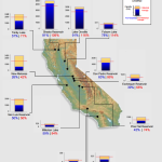
Cumulative precipitation is about average in San Joaquin and Tulare basin regions and above average in Northern Sierra.
Reservoir Conditions
Water levels in California’s major reservoirs (representing 27.3 million acre-feet of storage) have slightly increased to 62% of statewide capacity, compared to 59% two weeks ago. Levels are considerably higher than last year, but represent about 88% of group average for this date. Lake Oroville, Shasta, and Folsom, are now at 116%, 109%, and 114% of historical average, respectively. With an exception of the New Melones, reservoirs with less than 50% of average water levels are in the South Coast and Tulare Lake Basin.
Groundwater Conditions
Most recent data on groundwater conditions are based on fall 2015 measurements. Maps of spring and fall groundwater level changes can be found here and a map highlighting significant changes is available here. Areas with the greatest concern, i.e., those areas where groundwater levels have declined by more than 100 feet, can be found in parts of the Tulare Lake, South Coast, and Colorado River hydrologic regions.
Hydropower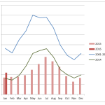
Hydroelectric power generation in January 2016 was about 1,100,000 MWh, which is about 30% higher than 2015 but 53% less than the 2001-2011 January average.
March 29, 2016
This week in… The Delta Dilemma
The Sacramento-San Joaquin Delta provides a portion of the water supply for more than 23 million Californians and serves as a vital habitat for over 500 species of wildlife. Water management in the Delta has always been contentious; federal and state agencies must balance the needs of people and the environment, especially in times of water shortage. Following large storms in early March, Senator Dianne Feinstein (D-Calif) and House Majority Leader Kevin McCarthy (R-Calif) called on President Obama to direct federal agencies to maximize water exports to Central Valley farms and southern California cities. On the other hand, the Bureau of Reclamation, a federal authority that operates pumping facilities in the Delta, is considering reducing diversions under the advice of the Fish and Wildlife Service due to the presence of smelt larvae. The smelt population is an important part of the Delta’s food chain and a biological indicator of the ecosystem’s health. Water diversions harm fish populations by drawing fish and their predators to the same area and pulling small fish and their eggs into the pumps.
These recent events occurred amid debates over the twin tunnels project in the Delta, officially known as the California WaterFix. The plan would add water intakes and tunnels north of the Delta and away from smelt habitat, but many are concerned over future increases in water exports and impacts on the water supply and ecosystems.
In other news…
–The Department of Water Resources increased State Water Project allocation to 45%, a ten percentage point increase since late February. The Bureau of Reclamation has not yet announced its Central Valley Project Water Supply allocation; officials say they need time to produce accurate projections to balance operations for agricultural, municipal, and environmental purposes.
–Preliminary estimates from the California Employment Development Department show farm employment grew by 7% in 2015, an increase of 30,000 jobs from 2014 levels. Agricultural employment increased in every part of the state. The growth could be a consequence of shifting to more labor-intensive permanent crops, such as almonds and pistachios. Farm input costs also rose in the same period.
-The Los Angeles Department of Water and Power (LADWP) proposed to set up a better mechanism to discourage wasteful uses of water during the drought. Currently, violations such as hosing down driveways and outdoor watering on off days can cost customers from $100 to $300. Under the new plan, fines would increase as drought conditions worsen. In the worst drought conditions, fines would range from $400 to $1,200 per violation. The motion is being considered by the City Council for approval.
-Congressmen Jared Huffman (D-San Rafael) and Dana Rohrabacher (R-Huntington Beach) introduced the Water Conservation Tax Parity Act to clarify that turf rebates, like energy rebates, are not taxable. Although the bill will not become law before the tax filing deadline of April 15, it would be retroactive to allow for a future refund. Currently, the State of California provides tax exemption for turf rebates, but the Internal Revenue Service and the Department of Treasury consider them as taxable income.
-The use of water tanks in Tulare County is becoming a norm for hundreds of families who lack access to running water. Last summer, Tulare County reported about 1,400 private well failures. The county began installing 3,000-gallon tanks and delivering water to residents for free. Initially, only homeowners qualified for the program, but renters were added in December 2015. Currently, there are about 1,500 cumulative reported domestic well failures due to the drought.
-The City of Santa Barbara will not pursue a subsurface ocean intake for its desalination plant after a study revealed that the process would be infeasible or fail to meet the city’s plan for a large desalination system. The study was criticized for basing its design on a 10,000 acre-feet annual production baseline to account for future expansion, while the proposed desalination plant is currently designed for 3,125 acre-feet per year. Its alternative, an open ocean intake, is typically less expensive but is more harmful to microorganisms and other marine species that are pulled into the intake system.
-Citing new supply deals and water conservation successes, agencies including the Laguna Beach County Water District and Moulton Niguel Water District recently backed out of a desalination project in Dana Point, Orange County. The South Coast Water District is currently the sole project proponent.
-President Obama issued a Memorandum and a Federal Action Plan on building national capabilities for long-term drought resilience. The two documents called for data collection and sharing, better communication about drought risk on critical infrastructure, and government support for water conservation and efficiency research.
-The EPA recently released a “Drought Response and Recovery Guide,” which provides worksheets, best practices, videos, and key resources for water agencies to respond to drought emergencies and build long-term resilience. The guide offers lessons learned from seven small- to medium-sized utilities nationwide, including a case study from Tuolumne Utilities District in Sonora, California.
California Drought Status
Drought Monitor
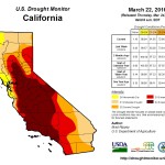 Drought conditions have slightly improved over the last two weeks. Areas under exceptional and extreme drought conditions have shrunk to about 56% of the state. Improvements occurred mostly in the north; long-term severe drought conditions are still entrenched in much of central and southern California.
Precipitation
 Following heavy precipitation events in early March, dry weather returned to many parts of the state. Snow-water content is at 86% of normal for this date, as of March 28 (see these snowpack plots for changes over time). Cumulative precipitation is about average in the San Joaquin and Tulare basin regions and above average in the Northern Sierra.
Reservoir Conditions
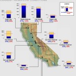 Water levels in California’s major reservoirs (representing 27.3 million acre-feet of storage) have slightly increased to 59% of statewide capacity, compared to 52% two weeks ago. Levels are considerably higher than last year, but represent about 86% of group average for this date. Lake Oroville, Shasta, and Folsom are now at 113%, 109%, and 109% of historical average, respectively. However, many reservoirs in the South Coast and Tulare Lake Basin are still at about 20% to 40% of average capacity.
Groundwater Conditions
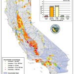 DWR published a map of groundwater level changes from fall 2011 to fall 2015. Areas with the greatest concern, i.e., those areas where groundwater levels have declined by more than 100 feet, can be found in parts of the Tulare Lake, South Coast, and Colorado River hydrologic regions.
March 15, 2016
This week in… Rain, Reservoir Releases, and Restrictions
Reservoir operations in California typically follow specific rules to balance water demand, flood control, and other beneficial uses of water. Amid storms in early March, the Bureau of Reclamation began releasing water from Folsom Reservoir to prepare for potential floods. The dam is an important part of the Sacramento region’s water resources management system, providing water to people, fish and wildlife, hydroelectric power generation, flood protection, and salinity-control requirements in the Bay-Delta. Water releases have increased from the initial 8,000 cubic feet per second (cfs) to about 20,000 cfs to accommodate inflows from Sierra runoff. Additional releases may be required based on actual and forecasted inflows into the reservoir.
Folsom reservoir’s strict storage level of 60% of capacity in winter months has drawn criticism as these releases present a water shortage risk if spring precipitation is deficient. Several groups are calling for the Bureau to develop new reservoir operation rules, which integrate weather forecasts to help determine when and how much water to release.
Meanwhile, Senator Dianne Feinstein (D-Calif) is calling on the Bureau to increase pumping in the Sacramento-San Joaquin Delta, within bounds of the Biological Opinions, to capture water from recent storms and transport them to drought-stricken farms and cities in Central and Southern California. Subject to pumping restrictions under the Endangered Species Act, the federal agency determines water diversion activities in the Delta based on water quality, temperature, recent fish counts and location relative to the pumps, among other factors.
In other news…
-A recent snow survey showed statewide snowpack at 83% of the March 1 average. Unless California receives heavy rain as much as it did during the “March Miracles” of 1991 and 1995, drought conditions will persist for another year.
– The California and Oregon Departments of Fish and Wildlife estimated that the population of the autumn run Chinook salmon in the Klamath River is about a third of last year’s estimate and the second lowest predicted since 1996. The low prediction number is based on the combined effects of climate change and the ongoing California drought. Meanwhile, delta smelt count has hit the lowest level ever recorded for January and February.
– The board of the Metropolitan Water District of Southern California, the largest water wholesaler in the state, voted to enter into a contract to buy four islands, spanning 20,000 acres, in the Sacramento-San Joaquin Delta. The purchase would be in the range of $200 million. The islands will be converted into fish and wildlife habitat and some areas will provide access for the construction of the twin tunnels to convey water to southern California. This deal is being sharply criticized by some Delta farmers and environmental groups due to potential impacts on water quality, flood control, and wildlife habitat.
– A new study by NASA, Scripps Institution of Oceanography at UC San Diego, and other partners found that atmospheric river storms in California’s Sierra Nevada are 2.5 times more likely than other types of storms to accelerate the melting of snow, with warmer rain falling on snowpack and causing it to melt.
– LA County is using cloud seeding technology to increase the amount of rainfall from existing clouds. Under the right atmospheric conditions, the method can produce 10-15% more rainfall, according to a county estimate.
– The California Natural Resources Agency recently released a report, titled “Safeguarding California: Implementation Action Plans,” which aims to enhance the state’s readiness for future droughts and other climate change impacts. The plan outlines current adaption efforts and actions that will be taken by state agencies.
– A proposed ballot initiative to support the construction of new reservoirs and water storage projects in California has sparked a new debate on the state’s priorities. The ballot initiative would shift $8 billion from the high-speed rail project to a newly created agency, the State Water Storage and Groundwater Storage Facilities Authority. It would also shift $2.7 billion from the water bond approved in November 2014 to the new authority to improve water supplies.
California Drought Status
Drought Monitor
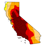 Drought conditions significantly improved over the last two weeks. Areas under exceptional and extreme drought conditions have shrunk to about 61% of the state. Storms had shifted southward, bringing rain to all of California except the southeastern tip of the state.
Precipitation
 California experienced a rapid transition from record warmth and dryness in February to a very wet March. However, it is unclear what the remainder of the month will look like.
Snow-water content is at 92% of normal for this date, as of March 15 (see these snowpack plots for changes over time).
Cumulative precipitation in the Northern Sierra and San Joaquin regions is above long-term averages, while it is about average in the Tulare basin.
Reservoir Conditions
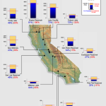 Water levels in California’s major reservoirs (representing 27.3 million acre-feet of storage) have significantly improved to 52% of statewide capacity, compared to 42% two weeks ago. Levels are considerably higher than last year, but represent only 81% of group average. Major reservoirs, such as Lake Oroville, Shasta, and Folsom, are now at 101%, 106%, and 120% of historical average, respectively.
A new interactive tool, by KQED News, shows changes in reservoirs’ storage levels since January 2010.
Groundwater Conditions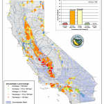
DWR recently published a map of groundwater level changes from fall 2011 to fall 2015. Areas with the greatest concern, i.e., those areas where groundwater levels have declined by more than 100 feet, can be found in parts of the Tulare Lake, South Coast, and Colorado River hydrologic regions.
Hydropower
 Hydropower generation in 2015 was about 13,700 GWh, 60% lower than the 2001-2011 average and 40% lower than the 2012-2014 drought-year average.
March 1, 2016
This week in… Recent Development in California Water Law
A number of drought and water bills were introduced to the California State legislature this month. The drought update will take a look at this recent development.
Democrat Sen. Diane Feinstein’s Drought Relief Bill
Introduced on February 10, 2016, this third proposal by Sen. Feinstein includes both short- and long-term provisions to allocate California’s water supply in dry times among many competing interests. It authorizes $1.3 billion for desalination, water recycling, surface water storage, and other grants. Focus is also given to easing limits on water transfers south of the Delta, but the bill does not mandate specific pumping levels. The Senator claims that the bill does not violate the Endangered Species Act, the Clean Water Act, and the Biological Opinions.
Rep. John Garamendi’s Drought Companion Bill
On February 23, 2016, Congressman John Garamendi (D-Fairfield, Davis, Yuba City) announced his plan to introduce another drought bill, which is intended to be a companion to the one developed by Sen. Feinstein. This move may be a result of concerns over future compromises to allow for increased diversions to farms in the south.
Assemblymember Bill Dodd’s Open and Transparent Water Data Act
New legislation, introduced by Assemblymember Bill Dodd (D-Napa) on February 2, 2016, aims to create a water transfer information clearinghouse to provide a platform for sharing water data. Current databases containing information on hydrology, biology, water quality, and water use are difficult to access and use to make decisions on water transfers in dry times.
Assemblywoman Ling Ling Chang’s Desalination Bill
Assemblywoman Ling Ling Chang (R-Diamond Bar) introduced a bill to encourage the production of potable water through desalination on February 12, 2016. It would urge the State Water Board to find economic and efficient methods to desalinate water to meet future demands. Currently, the bill does not specify desalination targets, but Ms. Chang is looking to establish a statewide goal before the final vote in August.
In other news…
- -The Department of Water Resources (DWR) released draft Groundwater Sustainability Plan Emergency Regulations. The regulations set standards and a framework for local public agencies to define a course of action to achieve sustainable groundwater management within 20 years of plan implementation. Local groundwater management plans must identify problems relating to groundwater (e.g., overdraft and seawater intrusion) and determine specific projects and management actions to address them. The DWR will provide technical and financial assistance for local agencies to develop their plans. -State Water Board authorized $960 million in 1% financing for near-term recycled water projects, funded through the Clean Water State Revolving Fund (CWSRF). Currently, 36 projects totaling 150,000 acre-feet of additional water annually are eligible for the 1% financing.-A recent UC Santa Cruz study notes limited research on sustainable groundwater management in critical groundwater basins of Southern California and Central Coast areas. While these regions had solved some conflicts between water users through an adjudication process, they lack mechanisms to manage groundwater resources sustainably. Water use practices do not take into account climate change nor address accumulated overdraft problems. The researchers recommend sustainable management requirements such as annual reports, specifications of safe yield and overdraft, procedures to reduce pumping, and triggers to spur further action.
-The US Bureau of Reclamation officials are still trying to determine their initial allocation of Central Valley Project water for 2016. The Project typically makes its initial allocations to cities, farms, and other entities in late February, but may require more time this year as weather predictions appear mixed. On the other hand, the Department of Water Resources has increased State Water Project allocation to 30%, a change from 15% announced a month earlier. This allocation may change again if more rain and snow arrive in California.-The Metropolitan Water District (MWD) announced that it may discontinue its turf rebate program. In a proposed budget for the next two fiscal years, MWD staffers recommended a conservation program budget of $27 million for 2017, and $32 million the year after. Funds will be allocated to an indoor water-efficient device rebate program, with no plan to reopen a turf rebate program.
California Drought Status
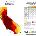 Drought Monitor
In February, California experienced record-high temperatures, especially in Southern California. The proximal cause of this record warmth and mid-winter dry spell is the development of a strong high pressure system that is aligned with the West Coast of North America. Seasonal forecasts have consistently underestimated the magnitude of subtropical ridging, which is causing many parts of California to remain dry despite El Niño conditions.
Drought conditions show no significant changes over the last two weeks. Wetter-than-normal conditions in the past week were confined to the northern-most counties and some parts of the Sierra Nevada. The federal Climate Prediction Center expects drier and warmer-than-normal conditions through much of California over the next two weeks, except for the North Coast. However, above-average rainfall in much of the state is expected for over the next three months.
Precipitation
 Snow-water content dropped to 85% for this date, as of February 29 (see these snowpack plots for changes over time).
Cumulative precipitation is still on course with the 1922-1998 average (see the Northern Sierra, San Joaquin, and Tulare Basin precipitation index charts). March-April-May forecast for California shows above-median rainfall. The outlook through early spring is likely associated with El Niño.
Reservoir Conditions
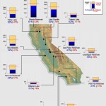 Water levels in California’s major reservoirs (representing 27.3 million acre-feet of storage) have slightly increased to 42% of statewide capacity, compared to 40% two weeks ago. These levels also represent 63% of group historical average, and 93% of what they were last year. Major reservoirs such as Lake Oroville, Shasta, and Folsom are now at 75%, 83%, and 112% of historical average, respectively.
February 17, 2016
This week in… Unintended Journey of Desal Water
Two months after the Carlsbad desalination plant came online, the San Diego County Water Authority (SDCWA), the sole buyer of the plant’s water, directed half a billion gallons of recently desalinated water to a lake near Chula Vista, where it must be re-treated before entering distribution pipelines. This order came as result of the region’s overabundance of water supply; the county already had 99% of the water needed for normal usage since November 2015. Additionally, the statewide conservation mandate lowered the demand further. By January 2016, a few weeks after the Carlsbad plant began operation, the SDCWA asked the Metropolitan Water District (Metropolitan), its main wholesale water supplier, to stop deliveries. However, Metropolitan responded that it was technically infeasible to do so without making physical changes to its pipelines. Restrictive terms of contract with the company that owns the Carlsbad desalination plant, Poseidon Resources, also prevented the SDCWA from buying less of the expensive desalinated water. Currently, the cost of Carlsbad plant’s desalinated water is at least $2,131 per acre-foot, while Metropolitan-treated water is about $942 per acre-foot and the SDCWA’s own water treatment facility’s water is $830 per acre-foot. The SDCWA expects desalination costs to be lower than water imports from Metropolitan between 2027 and 2042. A series of questions emerged from the unfolding of this event. Is desalination an appropriate solution for California’s water problems? How are conservation efforts affected by a financial lock-in of desalinated water purchase? What are the tradeoffs between supply reliability and cost burden on ratepayers? And are those tradeoffs justifiable given alternative supply options? Australia may be able to provide a few key lessons. Over the course of its decade-long drought period, the nation built six large seawater desalination plants ranging in size from 35 million to 120 million gallons per day. Four of those plants have been mothballed since the end of the drought, including Victoria’s $4 billion plant, the nation’s largest desalination facility. Perhaps, California should be more wary of desalination development, and follow Australia’s footsteps in urban and agricultural water conservation, water recycling, and stormwater capture, which are cost-effective and environmentally-benign solutions that remain useful in times of uncertainty.
In other news…
– The California State Water Board adopted a revised emergency regulation on urban water conservation through October 2016. Under the revised regulation, the statewide water conservation goal is to exceed 20% of 2013 water use. It takes into consideration factors that influence water use in different parts of the state, such as the hotter-than-average climate, population growth, and significant investments in new local, drought resilient water supplies such as water recycling and desalination.
– Cumulative urban water use reduction for June to the end of 2015 is currently at 25.5%. Monthly conservation fell to 18.3% in December. Despite a decline in the urban water conservation rate in the late fall and winter months, California continues to meet its overall reduction target of 25% of 2013 levels, or about 1.2 million acre-feet annually.
– NOAA forecasts a El Niño weakening through spring with conditions potentially transitioning to La Niña this coming fall. However, considerable uncertainty remains. For California, where El Niño effects are typically delayed, the National Weather Service’s Sacramento office said that El Niño is taking a five to ten day break due to high pressure, bubble-like system currently blocking incoming storms.
– A new study, published in Geophysical Research Letters, found that drier conditions are becoming a new normal for southwestern states. Analyzing 35 years of data, researchers identified weather patterns that are typical in the contiguous US and determined whether those patterns are becoming more or less frequent. Results suggested that the Southwest, and especially California, has experienced between 2.0% to 6.5% reduction in precipitation per decade between 1980 and 2010.
– Despite the ongoing drought, California farms had record sales in 2014, according to a new state report. Total agricultural sales were about $54 billion, a 5.1% increase over the 2013 level. Experts cite two key reasons for this strong performance: California almond export boom and the ability of farmers to tap into deeper, bigger wells.
– A new study shows reduced hydroelectric generation during the California drought, resulting in increased electricity costs and greenhouse gas emissions from a shift to other energy sources. Production decreased to 7% of the state’s electricity needs in the 2015 water year, compared to 18% in an average year.
California Drought Status
Drought Monitor
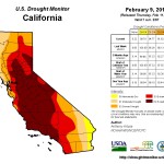 Areas severely affected by the drought continue to shrink. As of February 9, 38.48% of the state is in exceptional drought, compared to 44.84% three months ago. The drought situation is still serious despite heavy rainfall in January.
Precipitation
 Snow-water content and rainfall appear to be following an average year pattern (see the Daily Regional Snowpack Plot and the Northern Sierra, San Joaquin, and Tulare Basin precipitation index charts). Clear weather and warm temperatures over the long weekend have led to a decrease in snow-water content, which is now 91% of the normal level for February 16.
Reservoir Conditions
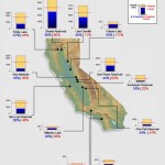 Water levels in California’s major reservoirs (representing 27.3 million acre-feet of storage) have increased to 40% of statewide capacity, compared to 35% two weeks ago. These levels represent 62% of group historical average, and 91% of what they were last year. Major reservoirs such as Lake Oroville, Shasta, and Folsom are now at 71%, 80%, and 116% of historical average, respectively.
February 2, 2016
This week in… Critically Overdrafted Basins
The Department of Water Resources (DWR) released the final list of critically overdrafted basins, defined as groundwater basins that would suffer significant adverse environmental, social, and economic impacts from the continuation of present water management practices. These basins overlay many important agricultural lands in Central Valley and coastal cities. Basic data in several groundwater basins, such as how much water is withdrawn, where it was pumped from, and how much remains in the aquifers, have generally been lacking in California despite the fact that the state pumps nearly one-fifth of all groundwater withdrawn in the U.S. annually. Therefore, DWR’s evaluation was based on a review of available data, reports, and other information used to identify basins with clear evidence of adverse impacts. As the assessment covered 1989 to 2009, conditions of these critically overdrafted basins are expected to worsen during the current drought.
Click here to see the North Central and South Central Regions data in more detail. Click here to see the Southern Region data in more detail.
In other news…
– State Water Board adopts measurement and reporting regulations for water diverters. The regulations now require annual reporting for all water right holders and claimants, with details of monthly uses. The rules mainly affect riparian and pre-1914 right holders who were previously required to report every three years, and measurement requirements could be avoided if they are deemed not “locally cost effective.” About 70% of these right holders claimed this exemption. New regulations implement Senate Bill 88, which was passed in June 2015. While this is an improvement to water diversion tracking in California, Colorado, some states in Australia, and parts of Spain are already collecting real-time measurements in one centralized accounting platform.
– El Niño-fueled stormy conditions are expected to make a brief return to Southern California and the southwestern United States. Cities are preparing to capture this rain with examples including Fresno Irrigation District’s groundwater banking projects, LA’s StormCatcher program to retrofit homes with permeable landscaping and ‘smart cisterns’, and Orange County Water District’s aquifer recharge with wastewater. The NOAA’s forecast also predicts wet weather in the next three months, especially for southern regions. The state has a 33% chance of above-average precipitation through April, and temperatures are predicted to be higher than average as well. This could mean more rain, but less snowmelt water to last through the summer months.
– Scientists at UC Davis are studying the effects of groundwater recharge on almond farms. Some orchards in the Central Valley are being flooded as part of this experiment. It has been estimated that between 3.6 and 5.6 million acres of agricultural fields are suitable for recharge projects. Over-irrigation allows water to infiltrate into aquifers, thus restoring groundwater levels in critically overdrafted basins. However, such activity also poses risks of root damage and contamination of fertilizers and pesticides in groundwater.
– The DWR and Bureau of Reclamation released a Final 2016 Drought Contingency Plan regarding SWP and CVP water allocation. The plan focuses on project operations and potential modification requests to balance the competing needs and benefits of limited water supplies. Following the release, the Bureau of Reclamation announced a CVP water supply conditions update, which shows lower storage levels for 2016 compared to previous years. On the other hand, the DWR is more optimistic about winter storms and water supply increases, thereby boosting SWP allocation to 15% (from 10% announced in December).
– A discussion draft for the new California drought relief bill has been released by Senator Dianne Feinstein (D-Calif). Short term provisions include an increase in pumping during winter storms, expanded water transfers, and plans to re-operate the Delta cross-channel gates. Long-term provisions aim at developing water storage (with an emphasis on dams and reservoirs), desalination, and water recycling projects, and providing financial assistance to drought-stricken communities.
California Drought Status
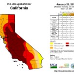 Drought Monitor
California is undergoing a slow and steady drought recovery. As of January 28, 40.21% of the state is in exceptional drought, an improvement of about 1.5 percentage points from the previous week. Signs of the modest dent to drought conditions are starting to show, e.g., water-year-to-date precipitation has eliminated most of California’s short-term drought (now only in the west-central coast).
A new visualization of drought conditions is now available. Clear improvements in California are shown between November and December 2015.
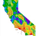 Precipitation
The weekend storm pushed statewide snow-water equivalent average to 20.2”, or about 116% of the normal average, as of February 1. Snowpack is currently the deepest it has been in five years, since the onset of the drought. Cumulative precipitation since the beginning of the 2016 Water Year (Oct 1) is following the course of the 1997-98 wet years (see Northern Sierra, San Joaquin, and Tulare Basin precipitation index chart).
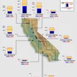 Reservoir Conditions
Water levels in California’s major reservoirs (representing 27.3 million acre-feet of storage) have increased to 35% of statewide capacity, compared to 30% two weeks ago. These levels also represent 60% of group historical average, and are at 91% of their level last year. Major reservoirs, such as Lake Oroville, Shasta, and Folsom are now at 66%, 76%, and 104% of historical average, respectively.
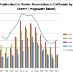 Hydropower
Hydroelectric power generation in November 2015 was about 650,000 MWh, or 22% lower than in 2014 and 63% lower than the 2001-2011 November average.
January 19, 2016
This week in… Budgeting for Water Woes and the Updated Water Action Plan
Since the declaration of the drought emergency in January 2014, the State of California has worked to appropriate $3.7 billion to assist drought-impacted communities, provide additional resources for critical water infrastructure projects, and respond to drought-related wildlife emergencies. Governor Brown’s proposed 2016/17 state budget would provide an additional $323.1 million on a one-time basis to continue emergency response to the drought. The budget includes $68.5 million for protecting water supplies, such as emergency salinity barriers and emergency drinking water projects; $95 million for water conservation, such as appliance rebates and education programs; and $159.7 million for emergency response, such as food assistance and fire protection.
Aside for the drought measures, the proposed budget includes funding for implementing the California Water Action Plan, a five-year roadmap for sustainable water management. Notable funding increases include $385 million to support projects that meet the state’s commitments under the Klamath Agreements ($250 million), the Central Valley Project Improvement Act ($90 million), and the San Joaquin River Settlements ($45 million). An additional $80 million would go toward Salton Sea Restoration for dust suppression and expansion of migratory bird habitat. The Salton Sea is an important ecological hotspot, with hundreds of thousands of resident and migratory birds each year, and the funding would help to complete two plans to address health and environmental consequences of the lake’s decline, which is expected to accelerate in 2018 when water deliveries by the Imperial Irrigation District to the saline lake will end.
Following the release of the 2016/17 budget proposal, the state published its Water Action Plan 2016 Update to reflect the progress that took place since January 2014 as well as future activities. The Plan provides the foundation for Proposition 1, the 2014 water bond, and the administration’s legislative agenda to work toward sustainable water management solutions. Commitment to making conservation a California way of life is emphasized through an expansion of agricultural and urban water conservation and efficiency measures to exceed SBX7 7 targets and a requirement for all agricultural water districts that supply water to 10,000 to 25,000 acres of irrigated lands to develop agricultural water management plans. The CA Water Action Plan also highlights the need to implement the controversial Delta Plan, which was bifurcated into the California WaterFix (water supply and delivery infrastructure initiative) and the California EcoRestore (habitat restoration and ecosystem improvement initiative).
In other news…
– The State Water Board recently adopted a statewide Storm Water Strategy to support strategic expansion of stormwater capture projects. Once considered as a water quality problem, storm water can help to augment the water supply via green infrastructure, such as permeable pavements, rain gardens, and bioretention cells.
– On January 5, the State Water Board authorized the sale of $1.2 billion in revenue bonds to fund additional recycled water projects. The money is an extension of the existing Clean Water State Revolving Fund.
– The U.S. Forest Service has begun an investigation into Nestlé Waters North America’s bottling operations in San Bernardino National Forest, Southern California. It has been collecting an annual fee of $524 from the company, which has been withdrawing water under an expired permit. The piping system draws about 68,000 gallons of water a day on average out of the forest. The Forest Service does not collect fees for the water.
– The current El Niño, dubbed “Darth Niño,” has caused widespread flooding in southern California. Some flooding and other impacts across northern California are expected this week. Despite heavy rainfall, the drought period is likely to continue as major reservoirs are still below historical average (see drought status below) and the storms are not expected to boost groundwater to normal levels after four years of drought.
– California urban users missed the 25% statewide water conservation goal in November, but have saved a combined 26% since the mandate was implemented in June 2014. News of regions having missed local monthly conservation targets, such as the San Diego region, Modesto, Ceres, and Coachella Valley, continue to surface across the internet. Persistent failure to meet this goal has led the Eastern Municipal Water District, in Riverside County, to impose a cut of 70% to residential irrigation. To prepare for persistent drought conditions, the State Water Board released a draft emergency regulation to continue urban water conservation until October 31, 2016.
– The World Economic Forum’s 2016 Global Risks Report ranked water crises as the top global risk for the next 10 years. It is the first time in the report’s publishing history (since 2006) that an environmental risk topped the ranking. The report is based on global risk outlook assessments by about 750 experts and decision-makers.
California Drought Status
 Drought Monitor
Exceptional drought conditions have improved by about 2.2 percentage points since last week, reducing the affected area to 42.66% of the entire state.
Precipitation
The statewide snow-water equivalent average has increased to 15.9”, or about 111% of the normal average for January 19. Central Sierra experiences above-normal snow-water depth at 115% of the normal average, while it is 91% for the Southern Sierra. Snowpack’s water content is far greater than one year ago. See here for interactive regional snowpack plots.
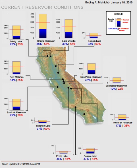 Reservoir Conditions
Water levels in California’s major reservoirs (representing 27.3 million acre-feet of storage) are now at 30% of statewide capacity and about 50.17% of group historical average. Current levels are about 80% of what they were last year.
January 4, 2016
This week in… Sinking Earth
From the Pacific Institute California Drought Response Group
Four years of drought and groundwater overdraft are causing the earth to sink faster in Central Valley, one of the nation’s prime agricultural lands. Recent damage in the lining of the Delta Mendota Canal, which delivers irrigation water to Central Valley Project contractors, is among many signs that land subsidence is worsening due to the area’s rapid decline in groundwater levels. New data from NASA’s Jet Propulsion Laboratory indicates than land near Corcoran in the Tulare basin has already sunk 13 inches in eight months, and one area in the Sacramento Valley was sinking at a faster rate (0.5 in. /month) than previous measurements indicated. While subsidence may have multiple causes (e.g., drainage of organic soils for agriculture leads to compaction and sinking), the most common is from over-pumping of groundwater. Subsidence occurs throughout California and it can increase the risk of flooding and damage pipelines, roads, and canals, for example. Past spending on infrastructure repairs due to subsidence was estimated at $1.3 billion. New repairs are expected to cost at least as much. As the sunken land cannot move upward even when groundwater levels are restored, the best way to address subsidence is to prevent the ground from falling further by recharging aquifers and tapping into alternative water supplies, such as through conservation and water reuse.
In other news…
-
-
-
-
-
-
- -Complications in the controversial Delta islands purchase have arisen due to pre-existing legal restrictions on how the islands can be treated. Metropolitan Water District of Southern California (MWDSC) is working with three Kern County agricultural water agencies to buy five islands in the Delta, currently used for farming. The agencies have expressed interest in engaging in environmental restoration as a means to improve existing water deliveries. The purchase may also help to boost the Twin Tunnels project as MWDSC is a project proponent and two of the islands are situated along the proposed tunnels route.
-
-
-
-
-
-
-
-
-
-
-
- -The State Water Board releases proposed regulatory framework for extended emergency regulation for urban water conservation in 2016. Among key recommendations are an incorporation of a climate adjustment to reduce the conservation requirement of water suppliers in warmer regions by 4 percentage points, a baseline adjustment to account for water-efficient growth, and provision of credits to reduce the conservation standard if at least 4% of suppliers’ potable water comes from new drought-resilient supplies, such as indirect potable reuse of coastal wastewater or seawater desalination.
-
-
-
-
-
-
-
-
-
-
-
- –NASA experts warn of destructive impacts of the “Godzilla” El Niño in early 2016. The latest satellite imagery suggests that the current El Niño may be more powerful than the strongest one ever recorded (the winter of 1997-98). The incoming storms offer hope of improved drought conditions, but their effects will likely be mixed as risks of mudslides and flooding will increase in some places.
-
-
-
-
-
-
-
-
-
-
-
- -A recent study by Greg Asner and his team from the Carnegie Institution of Science reveals drought impacts on California’s forests over the last four years. Of the 41,000 square miles surveyed, almost 890 million large trees have experienced losses of canopy water, and nearly 60 million giant redwoods and sequoias are at risk of dying, which could lead to substantial and long-term changes in the ecosystems and biodiversity.
-
-
-
-
-
California Drought Status
Drought Monitor
 As of December 29, drought conditions continue to improve with 10% of the state now under moderate drought conditions, an increase from 6.7% two weeks ago. However, about 45% of the state still experiences exceptional drought conditions.
Precipitation
 Statewide snow-water equivalent average has increased to 10.2” or 105% of normal, as of December 30. Central Sierra experiences above-normal snow-water depth at 116% of normal average, while it is 86% for Southern Sierra.
Reservoir Conditions
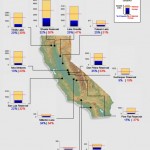 Water levels in California’s major reservoirs (representing 27.3 million acre-feet of storage) have increased slightly from 24% to 25% of statewide capacity and from 43% to 45% of group historical average. Current levels are about 70% of what they were last year.
Hydropower
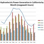 Hydroelectric power generation in October this year was 8% lower than in 2014, but 53% lower than the 2001-2011 October average.
December 21, 2015
This week in… the Water Storage Investment Program
As 2015 draws to an end, the California Water Commission, tasked with allocating funds for water storage projects under the Water Quality, Supply, and Infrastructure Improvement Act of 2014 (Proposition 1), is beginning its formal rulemaking process to inform how funding will be prioritized and to determine the grant application process. Proposition 1 sets aside $2.7 billion in bonds to invest in water storage projects. Expected to begin in 2017, funding can cover up to 50% of a project and at least 50% of such funds will be used for ecosystem benefits. The Water Commission completed a scoping survey earlier this year to gauge prospective applicants’ interest in the program. A sample of potential projects include CalFed’s Temperance Flat Project (average yield: 96,000 AFY, cost: $1.0 – $1.4 billion), Tulare Lake Project (capacity: 70,000 – 120,000 AF)*, and CalFed’s Sites Reservoir or North-of-the-Delta Offstream Storage Project (average yield: 500,000 AFY, cost: $4 billion). However, these expensive megaprojects are not the only ones on the table. Groundwater storage and conjunctive use also qualify for the Water Storage Investment program. With potential storage capacity between 850 million and 1.3 billion acre-feet throughout California’s 515 groundwater basins, groundwater recharge and storage offers a much lower cost than other surface storage projects. The final regulations and guidelines, which are due in the coming months, will help to determine whether California is ready to move toward the ‘soft path’ for a sustainable water future.
*Cost data unavailable
In other news…
– The largest seawater desalination plant in the United States, with 50 MGD capacity, officially opened on December 14, 2015. Located in Carlsbad, in San Diego county, the plant can meet 7 to 10 percent of the region’s demands if operated at full capacity. This $1 billion project is expected to increase potable water bills for an average customer by about $5 per month. Due to the technology’s high energy use, plant officials plan to spend about $200,000 a year to buy carbon offsets. The plan also includes the San Diego Bay environmental mitigation program, but further study is required to understand and quantify long-term environmental impacts (e.g., effects on marine life from the plant’s seawater intake and brine disposal) of desalination.
– The Natural Resources Defense Council (NRDC) recently issued a report card for the state of California’s drought responses. The report covers five strategies identified to achieve a sustainable and drought-resilient future. The state made the most progress in urban water conservation, scoring a B through achieving water conservation targets and implementing strategies to improve plumbing fixture and appliance water use efficiency. However, it failed to make any headway to improve the San Francisco Bay-Delta ecosystem, receiving an F as a result. Scores of B-, D, and D were given to water recycling, agricultural water conservation and efficiency, and storm water capture and reuse, respectively. See the State Water Board’s response here.
– The 2016 State Water Project allocation is initially set at 10 percent of most SWP contractors’ requests, or about 420 thousand acre-feet. This allocation may change throughout the year given current and projected hydrological conditions. Last water year (1 Oct 2014 – 30 Sept 2015), initial allocation was at 5 percent in November, decreased zero percent in January, then increased and remained at 5 percent for April until the end of the water year.
– A Republican-backed drought bill (“The Western Water and Food Security Act of 2015”), which aims to maximize deliveries from the Delta and boost water storage, reuse, and recycling projects, will not be included in the must-pass $1.1 trillion omnibus spending bill. Disagreements between Democrat and Republican lawmakers were mainly on operational criteria of the Delta and environmental protection.
– The State Water Board voted against a plan to hold back an additional 200,000 acre-feet of water at Lake Shasta through October 2016. The plan would help to ensure that water released into the Sacramento River would be cool enough for next year’s juvenile salmon run. Instead, the new order provides more flexibility for the Central Valley Project (CVP) and the State Water Project (SWP) operations, requiring a temperature plan and setting 1.6 million acre-feet storage volume as the planning target.
California Drought Status
Drought Monitor
![]() Drought conditions improved slightly from last week after the weekend storm. Regions with severe drought decreased from 23% to 22%, but areas with extreme drought and exceptional drought remain the same at 24% and 45%, respectively.
Drought conditions improved slightly from last week after the weekend storm. Regions with severe drought decreased from 23% to 22%, but areas with extreme drought and exceptional drought remain the same at 24% and 45%, respectively.
Precipitation
![]() Statewide weighted average precipitation is at 82% of the historical average. Snow-water equivalent average for the state is currently at 6.9” or 83% of normal for December 15.
Statewide weighted average precipitation is at 82% of the historical average. Snow-water equivalent average for the state is currently at 6.9” or 83% of normal for December 15.
Reservoir Conditions
![]() Statewide, California’s major reservoirs (representing 27.3 million acre-feet of storage) are at 24% of capacity and 43% of group average.
Statewide, California’s major reservoirs (representing 27.3 million acre-feet of storage) are at 24% of capacity and 43% of group average.
Hydropower
![]() Hydroelectric power generation in September this year was 12% higher than 2014, but 43% lower than the 2003-2013 average.
Hydroelectric power generation in September this year was 12% higher than 2014, but 43% lower than the 2003-2013 average.
October 13, 2015
This week in… Governor Brown’s Office
On Friday, October 9th, Governor Brown signed 24 bills related to water management and use. Among these, the following are particularly notable:
–SB 555 requires California’s urban water departments and private water companies to audit their systems and report their annual water loss to the state starting in Oct. 1, 2017.
–AB 1164 bars cities and counties from enforcing laws that prohibit residents from replacing lawns with artificial turf or other drought-tolerant landscaping.
–AB 401 directs the State Board to report to the Legislature on its findings regarding the feasibility, financial stability, and desired structure of a Low-Income Water Rate Assistance Program. The report will include any recommendations for legislative action that may need to be taken.
–SB 664 requiring water agencies to assess water infrastructure systems and report on their vulnerability to earthquakes. The bill was authored by state Sen. Bob Hertzberg, D-Van Nuys
–AB 617 and AB 939 add some clarifications to last year’s Sustainable Groundwater Management Act. AB 1390 and SB 226 add special procedures and clarifications to the groundwater adjudication process.
–AB 606 will require state properties to modernize irrigation systems and to implement drought tolerant landscaping, with an emphasis on native plants. This bill was proposed earlier this year by the pupils in Ms. Laura Honda’s fourth grade class at Manor Elementary School in Fairfax, CA.
In other news…
–In the past two weeks, precipitation in California has been higher than average in the southeast and below average in the northwest.
-The rock barrier DWR constructed in the Delta in mid-June to protect water quality from saltwater intrusion is now being removed. The work will be completed by mid-November.
–Statewide water use in August was down 27% this year from 2013. Check out the August savings in our interactive data table and map.
California Drought Status
Drought Monitor
![]() Drought conditions remain unchanged from two weeks ago.
Drought conditions remain unchanged from two weeks ago.
Reservoir Conditions
![]() Statewide, California’s major reservoirs (representing 27.3 million acre-feet of storage) are at 27% of capacity and 48% of group average.
Statewide, California’s major reservoirs (representing 27.3 million acre-feet of storage) are at 27% of capacity and 48% of group average.
September 30, 2015
This week in… Days Gone By
Happy New Year, everyone!
Because the vast majority of precipitation typically occurs in the fall and winter, October 1st marks the start of a new water year.
2015 was, as expected, pretty bad. As we begin the new year, here are just a few of the ways we can reflect on the past:
![]() -At 58.4°F, the 2015 water year saw the highest average temperature (more than three degrees warmer than average) in 120 years of record-keeping.
-At 58.4°F, the 2015 water year saw the highest average temperature (more than three degrees warmer than average) in 120 years of record-keeping.
-The average minimum temperature in the Sierra Nevada this winter was 32.1°F, the first time it was above freezing in 120 years of record-keeping.
![]() –Average precipitation was below normal in most of the state for the entire year.
–Average precipitation was below normal in most of the state for the entire year.
-The April 1st snowpack was just 5% of the average since records began in 1950. This was lower than the previous record – 25% of average – set in 1977.
Obviously there is no way to be sure what 2016 will bring and a continuation of the current drought is still a possibility; in the past 90 years, California has experienced two six-year droughts.
The entire state – from individuals up through the state government legislators – has made significant progress in the past four years. Regardless to what happens in 2016, we must all resolve to keep working towards a more sustainable water future for California – in particular, one that is resilient in the face of long-term drought.
In other news…
-The State Water Resources Control Board lifted drought restrictions on those users with pre-1914 water rights in the Sacramento, Feather River watersheds, and the Delta.
-The Southern Nevada Water Authority agreed to sell 150,000 acre-feet of water to the Metropolitan Water District of Southern California, at the cost of $45 million.
California Drought Status
Drought Monitor
![]() Drought conditions remain unchanged from two weeks ago.
Drought conditions remain unchanged from two weeks ago.
Reservoir Conditions
![]() Statewide, California’s major reservoirs (representing 27.3 million acre-feet of storage) are at 28% of capacity and 49% of group average.
Statewide, California’s major reservoirs (representing 27.3 million acre-feet of storage) are at 28% of capacity and 49% of group average.
Hydropower
![]()
![]() Hydroelectric power generation in July this year was 18% lower than 2014 and 52% lower than the 2003-2013 average.
Hydroelectric power generation in July this year was 18% lower than 2014 and 52% lower than the 2003-2013 average.
September 17, 2015
This week in… Wildfires
Several large fires continue to rage across California:
-The Valley Fire has burned 67,000 acres and is still only 35% contained. The fire has killed two people and destroyed nearly 600 homes and hundreds of other structures in Lake, Napa, and Solano Counties. Governor Brown declared a state of emergency in Lake and Napa counties on September 14th.
-The Butte Fire has burned more than 71,000 acres and is 49% contained. On September 11th, the Governor declared a state of emergency in Amador and Calaveras counties.
-The Rough Fire is currently the largest fire in California, having burned nearly 140,000 acres. The fire is currently 40% contained.
Some of these fires have been exacerbated by the bark beetle, which thrives when trees are stressed and leaves behind more dead, dry trees that are ready to go up in flames.
To date, 7,344 fires have burned nearly 738,000 acres in California. Congress has indicated it will try to pass legislation this month that would address the nation’s increasing firefighting costs.
In other news…
- A new report issued by the National Oceanic and Atmospheric Administration projects an increase in coastal flooding between now and April, as a result of higher sea levels and more frequent storm surge, compounded by the strengthening El Niño.
- Speaking of El Niño…the U.S. Climate Prediction Center increased the probability that El Niño conditions will continue through the winter into spring 2016.
- In a paper published in the journal Nature Climate Change, scientists estimate that the amount of snow in the Sierra Nevada was the lowest it has been in more than 500 years.
California Drought Status
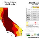 Drought Monitor
Drought conditions remain unchanged from two weeks ago.
Reservoir Conditions
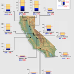
Statewide, California’s major reservoirs (representing 27.3 million acre-feet of storage) are at 29% of capacity and 49% of group average.
Read archived updates here.
